Building Tempe Town Lake

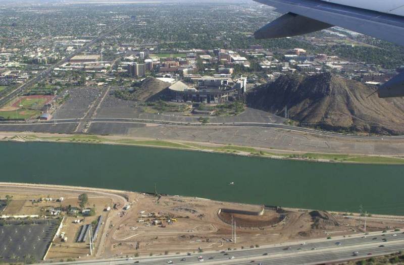
In 2003, Tempe Town Lake finally emerged on the bed of the Salt River after nearly 40 years of planning. In 1995, the beginning of the construction was marked by a huge ceremony near Tempe Beach Park, which was a focal-point for recreation in Tempe.. The concept for the lake called for dispersed islands, but plans were changed making the lake a body of water flowing along the channel.
The idea for the lake first developed in 1966, when a group of architecture students at the Arizona State University was challenged by the dean of the college of architecture to create a plan that could combine flood control and environmental design. The students created the “Rio Salado” project. The purpose of this project was to transform the Salt River into a major asset for the town of Tempe.
After years of public debate, construction work started in 1995 south of Curry Road in Papago Park. Bridges were built for people and cars to cross over the lake, which is two miles long and 800 to 1200 feet wide, depending on where it is measured. It can contain up to 980 million gallons of reclaimed water. Four years and many millions of dollars later, Tempe Town Lake was completed on June 2nd, 1999, and water from the Salt River started flowing in, filling it within a month and a half.
Later, on November 6th, 1999, a large opening ceremony was held to celebrate the completion of the project. More than 30,000 people attended the event, and Mayor Giuliano gave a speech concluding, “… and to the citizens of Tempe, this is your lake, this is your project, this is your legacy.” The lake was open to the public the very next day.
The dams of the lake are made out of strong, inflatable rubber barriers secured to a concrete base. These tubes are controlled by a system that regulates their inflation and deflation so the water can flow easily. On the west dams, water can flow over the top of the dams to create a waterfall. This water is then recollected and pumped back into the lake
The dam that produced the lake is only the most recent dam along the Salt River. As early as 1906, Arizonans sought to slow down the unpredictable flooding of the Salt River and to provide a consistent water source to the growing valley through the construction of dams. The Roosevelt Dam was dedicated on March 18, 1911. More dams and canals were constructed over the following years, and the Salt River was diverted in many places for agricultural, industrial, and domestic uses.
As the Salt River was dammed, the riverbed adjacent to Tempe (as well as Mesa and Phoenix) became drier and drier through the year, which is what prompted efforts to rethink the Salt River in the 1960s.
Images