<?xml version="1.0" encoding="UTF-8"?>
<feed xmlns="http://www.w3.org/2005/Atom">
  <title type="text">Salt River Stories</title>
  <updated>2026-04-17T19:35:32+00:00</updated>
  <generator uri="http://framework.zend.com" version="1.12.20">Zend_Feed_Writer</generator>
  <link rel="alternate" type="text/html" href="https://saltriverstories.org/"/>
  <link rel="self" type="application/atom+xml" href="https://saltriverstories.org/items/browse?output=rss2"/>
  <id>https://saltriverstories.org/</id>
  <author>
    <name>Salt River Stories</name>
    <uri>https://saltriverstories.org</uri>
  </author>
  <link rel="hub" href="https://pubsubhubbub.appspot.com/"/>
  <entry>
    <title type="html"><![CDATA[Sun City: A Revolution : Revolutionizing the Way Retirement Communities are Built Till This Day ]]></title>
    <summary type="html"><![CDATA[<p><strong><em>A groundbreaking retirement community born from a vast cotton farm and Del E. Webb's vision.</em></strong></p><img src="https://saltriverstories.org/files/fullsize/3bf26476fe8983285bbacc3a6c1a4de7.jpg" alt="Sun City and Stock Cars" /><br/><p>Sun City revolutionized housing and retirement in the United States. It became the nation's largest and most successful retirement development and contributed to a new formulation in how Americans thought about life during retirement. It provided reasonably priced housing along with amenities such as golf courses, shopping centers, and activities centers for arts and crafts, meetings, and entertainment. How did Sun City come into existence? </p><p>Sun City rose from the vision of Del E. Webb who built his business through developing projects for the local, state, and federal governments in the Southwest. Webb's company DEVCO (Del E. Webb Development Corporation) succeeded largely through procuring contracts funded by the federal government--first as a WPA project during the Depression and later from military contracts during World War II. By 1950, Webb was well-rehearsed in building military installations, commercial buildings, and in manufacturing construction. He even had a little experience in residential construction, having built a company town (San Manuel) in southern Arizona for the Magma Mining Company. </p><p>In the 1950s, the idea of building a community exclusively for people entering retirement was a novel idea, perhaps because the very idea of retirement itself did not yet have a long history. In the 1920s the Florida coast beckoned to some retirees. In 1950s Arizona, New York-born developer, Ben Shleifer built the first age-restricted community in Youngtown, Arizona, along the Agua Fria River northwest of Phoenix. Intrigued by these models, Webb and DEVCO's leadership team--known for meticulous research--began investigating this new phenomenon of retirement communities. According to historian Phil Vandermeer, “Webb directed company Vice President Thomas Breen to investigate constructing a retirement community, perhaps in Arizona.” Breen, who had been a champion of the idea, traveled to Florida and discovered that contrary to popular wisdom retirees did not necessarily want to remain close to family and friends in the North. They welcomed the possibilities of retirement and often desired more amenities in the communities to which they moved. With research showing a possible market for an "active" retirement community in Arizona, DEVCO moved forward with its project plans and started to search for land. DEVCO sought a large piece of affordable land, which took him to Jim Boswell and the edges of Phoenix. </p><p>At mid-century, Phoenix remained largely oriented around agriculture, but that was rapidly changing in the post-war era. So it was not at all surprising that when Boswell heard of Webb's interest in locating a plot of land to build his planned community that he offered to sell him his massive 10,000-acre cotton farm, land once owned by the Goodyear Tire Company for its cotton enterprise. Following World War II, softening demand for cotton as well as urban growth pressures in Phoenix altered the economy in the region. Farms became more valuable for their land than for the materials they produced, spurring growth across former cotton, citrus, and cattle ranches across Maricopa County. Boswell found a ready purchaser in Webb and the two formed a partnership; in exchange for his land, Boswell acquired part ownership in the project. As exhibits at the Del Webb Sun Cities Museum reported, “Jim Boswell saw the potential and formed a partnership with Webb, becoming a 49% owner in the Del E. Webb Development Corporation (DEVCO) with Del holding 51%.” Moreover, the agreement stipulated that Boswell could continue farming and that the partners would only buy land as it was needed for developing new subdivisions. </p><p>DEVCO moved quickly toward building the new subdivision and, perhaps, most importantly, it imagined retirement to be active rather than sedentary. The company first built the amenities that it hoped would draw buyers and make the community a more vibrant leisure-oriented retirement. In July 1959, DEVCO set to work building a nine-hole golf course, a clubhouse, lakes, a shopping center, and several model homes. Radio jingles from 1960 reflected the new ethos of retirement living as being a year-round vacation.
<p>"Wake up and live in Sun City </p><p>For an active new way of life. </p><p>Wake up and live in Sun City </p><p>Mr. Senior Citizen and wife. </p><p>Don't let retirement get you down! </p><p>Be happy in Sun City; it's a paradise town."
</p><p>Designing retirement communities around active leisure would transform Americans' sense of retirement and help to revolutionize the real estate business. In addition, by building Sun City around centers of activity, including a civic center, Webb set the town apart and drew on the most forward-thinking design ideas of the era. DEVCO intentionally did not name the development; instead, the company held a nationwide contest to name the community. <span>The company placed an ad in the Saturday Evening Post, promising to award a new home to the winner. This nationwide contest greatly contributed to the grand opening o</span>n January 1st, 1960 when Webb unveiled Sun City with surprising and resounding success. On the first weekend alone tens of thousands of people visited, some estimates put the number at more than 100,000 people. The company wrote so many contracts it ran out of the pre-printed forms; salesmen sat on the floor to write contracts. By April, DEVCO had sold all 400 homes that were slated to be built that year. </p><p>The homes also sold because they were affordable. DEVCO sold homes that cost between $8,000 to $11,300, below the median home value in the United States in 1960, according to the United States Census. DEVCO kept the costs down by employing the mass production methods deployed in earlier innovative master-planned communities, such as Levittown, developed in New York in 1947. The company's photos reveal the process: workers cleared the land, laid foundations, framed the simple dwellings, built roofs and walls, added windows, and so forth. Not surprisingly, as demand for the inexpensive though simple homes grew, so too did demand for more elaborate homes. </p><p>Once the novelty wore off, Webb and DEVCO worked to remain ahead of the demand curve, and to keep the Sun City's sales and growth brisk. The company engaged in an ongoing process of trial and error in finding better ways to sell the community. These marketing efforts included a “try before you buy” program that prompted potential buyers to come and view the community up close. By emphasizing community life, Meeker used the residents as a sales force; potential residents did not just buy a home but they bought into an active human community. Ultimately, Sun City became the largest development by a single builder in the country in history. Sun City encompasses more than 25,000 homes, 50 percent larger than the storied Levittown project in New York that has come to symbolize the post-war housing boom. The success of Sun City brought Del Webb national attention. Time Magazine even named him its 1962 “Man of the Year.”</p><p><em><strong><a href="https://saltriverstories.org/items/show/402">For more (including 5 images&#32;&amp;&#32;2 videos) view the original article</a></strong></em></p>]]></summary>
    <published>2019-12-05T05:46:28+00:00</published>
    <updated>2026-04-17T19:35:32+00:00</updated>
    <link rel="alternate" type="text/html" href="https://saltriverstories.org/items/show/402"/>
    <id>https://saltriverstories.org/items/show/402</id>
    <author>
      <name>Trevor Perry</name>
    </author>
  </entry>
  <entry>
    <title type="html"><![CDATA[The Wigwam Resort: <span>How did a company guest house evolve into a world-renowned resort?</span><span></span>]]></title>
    <summary type="html"><![CDATA[<p><strong><em>From a modest six-room guest house in the middle of the desert, to a sprawling lusciously green oasis, the Wigwam's 100-year transformation is fascinating.</em></strong></p><img src="https://saltriverstories.org/files/fullsize/868d6cbee5e80ca1b9e897336df357e5.jpg" alt="Port Call at The Wigwam" /><br/><p>In Arizona hotels and resorts emerged as a cornerstone for tourism early in the twentieth century; they became pivotal in “selling the desert”. Sprawling landscapes with luscious green golf courses, rows of palm and citrus trees, swimming pools, tennis courts, and spas presented the allure of the Mediterranean, the beach, or the tranquil Midwest. Located in the heart of Litchfield Park, Arizona, just 16 miles from central Phoenix, the Wigwam Resort embodied these sensibilities and invited both American and international travelers for much of the twentieth century. </p><p>The Wigwam emerged during World War I, emblematic of how the war transformed global industrial supply chains. The war disrupted global supplies of Egyptian cotton for the Ohio-based Goodyear Tire and Rubber Company (Goodyear), which sought alternative sources of cotton for its tire-making process. In 1916 the company sent executive Paul W. Litchfield to Arizona to ascertain whether the location would be suitable for cotton production. After validating the area’s viability, Litchfield created the Southwest Cotton Company as a subsidiary to Goodyear. He purchased 16,000 acres of land for the cotton company and began hiring workers, clearing the desert, and growing cotton. Meanwhile, he established a seasonal homestead for his family, in addition to a company operations complex. The company operations area, called Litchfield Ranch, later evolved into the downtown district of Litchfield Park. The company even built a house for visiting executives. The Organization House, as it was called, was a six-room house, of adobe construction that travel-worn Akron executives stayed in when visiting the cotton fields. Indeed, in 1918, traversing the sixteen-mile stretch of open desert from Phoenix to Litchfield Ranch took nearly the entire day. </p><p>Over the following decade, the Organization House expanded to a capacity of twenty-four rooms and then expanded again to a guest capacity of sixty-six. On Thanksgiving day, 1929 the Organization House opened to the public under the new name of The Wigwam Guest Ranch. At that point, Goodyear also had finished construction of a nine-hole golf course, and the improving infrastructure made it possible for people to travel into the desert to experience its exotic comforts. The seasonal resort operated from December to May which allowed wealthy families to enjoy the desert while avoiding the grueling summer heat. The Wigwam offered many opportunities to spend time on the 17,000-acre ranch from golf to hiking and swimming to lounging in the desert sun, even rides in company stagecoach or the Goodyear Blimp. The Wigwam maintained a steep rate for the time period, and all of the revenue went straight to Goodyear as the property and resort owner. </p><p>World War II transformed both Goodyear’s business and how it used the Wigwam. The Goodyear Company held a significant number of government contracts for war effort production, especially related to the manufacturing of military parts and equipment. Also, the company closed the Wigwam to the public and opened all of its rooms to Army fighter pilots stationed at Luke Field, later Luke Air Force Base. </p><p>Following the war, the Wigwam resumed its public resort operations and continued to expand both in building size and recreational activities. The nine-hole golf course became an eighteen-hole course. During the 1950s two more eighteen-hole courses opened and golfers from around the nation flocked to the Wigwam. The golden age of the Wigwam spanned from 1950 to 1986. </p><p>During the golden age, the resort extended its season to October through May and continued to expand its amenities and the luxurious environment that made it so popular. During the 1960s, Goodyear transformed its business in Arizona for multiple reasons, including an industry-wide shift away from using cotton in tires. Goodyear then closed its farming operation and transformed its holdings into a land development and home construction business. Goodyear pursued a series of pre-planned communities surrounding the Wigwam, which evolved the landscape into modern-day Litchfield Park. </p><p>The company abandoned Arizona completely in 1986 when it sold its remaining 13,000 acres, which included the Wigwam, to the Suncor Development Corporation at a cost of $221 million. Suncor opened the resort year-round for the first time since its construction in 1918. However, they sold the resort after four years to a Japanese investment firm, Kabuto, for $70 million. Kabuto invested $13 million into expansion which added 90 more guest rooms and a series of conference and event halls. In 2009 the Wigwam switched hands again. The JDM Partners, a local Arizona owners group, sought to restore the Wigwam to its glorious past with over $7 million in restorations and renovations. The Wigwam still operates today. </p><p>The Wigwam Resort currently offers 331 guest rooms, three championship golf courses, three pools (one with a 25-foot slide), nine tennis courts, and over 30,000 feet of indoor meeting space spread over 25 separate rooms.</p><p><h6 style="text-align:right;">edited 12/15/19: mtt</h6></p><p><em><strong><a href="https://saltriverstories.org/items/show/398">For more (including 5 images) view the original article</a></strong></em></p>]]></summary>
    <published>2019-12-05T02:02:46+00:00</published>
    <updated>2026-04-17T19:35:32+00:00</updated>
    <link rel="alternate" type="text/html" href="https://saltriverstories.org/items/show/398"/>
    <id>https://saltriverstories.org/items/show/398</id>
    <author>
      <name>Trevor Shackleton</name>
    </author>
  </entry>
  <entry>
    <title type="html"><![CDATA[Arizona&#039;s State Fair: The Depression Remade the Fairgrounds]]></title>
    <summary type="html"><![CDATA[<p><strong><em>From its humble beginnings amid heavy rainstorms to becoming host from everything from New Deal projects to Hollywood films and even a papal address, what exciting prospects lie ahead for this iconic venue?</em></strong></p><img src="https://saltriverstories.org/files/fullsize/6077ca45d1768c448538540536ca2f56.jpg" alt="Cactus Cowboy" /><br/><p>During the week of December 4, 1905, heavy rainstorms forced state officials to reschedule Arizona’s first territorial fair. Weeks later, on Christmas Day, the fair opened its doors. Governor Joseph H. Kibbey made a few opening remarks to more than 2,000 Arizonans who had arrived by train to partake in the festivities. Throughout the week, horse racing took place along with competitive company drills and other military exercises.</p><p>Beginning in 1905, the Arizona State Fairgrounds--located at McDowell Road and 17th Street--have changed dramatically. Once a rural outpost at the edge of Phoenix, the fairgrounds were eventually surrounded by housing and suburban sprawl and located in the central core of the Phoenix region. Likewise, the facilities have expanded their usage beyond being a centerpiece of the region's agricultural economy; eventually hosting concerts, movies, and other various forms of entertainment. In the 1930s, when state officials suspended the state fair during the Great Depression, the fairgrounds became home to the state's efforts to spur recovery during the New Deal. The fairgrounds housed the Works Progress Administration (WPA) office.</p><p>In the early 1930s, Arizona Governor Benjamin Moeur convinced FDR and the federal government to allocate funds for public works projects in the state during the Great Depression. The WPA eventually opened its state headquarters at the south end of the State Fairgrounds and funded a variety of projects throughout the state between 1938 to 1943. The WPA funded hundreds of projects with the intent of putting Americans back to work and improving the country’s infrastructure. Between 1935 and 1942, the WPA put 8.5 million Americans back to work and spent more than $10 million during the Great Depression. The agency funded numerous public works projects that included roads, bridges, schools, libraries, botanical gardens, memorials, and city halls.</p><p>In Phoenix, for example, the agency widened and resurfaced over 1,000 blocks of city streets, including five miles of Central Avenue from the Salt River Bridge to South Mountain Park. Throughout the city, workers excavated twenty-eight miles of ditches along roadways, fifty-eight miles of curbs, eighty miles of sidewalks, and five miles of gutters. The agency also planted hundreds of palm and orange trees along Van Buren Street between Phoenix and the Tempe bridge. In Arizona, the agency constructed 690 miles of highway and around 475 miles of miscellaneous city streets. By 1935, the federal government had become the largest employer in Maricopa County, putting $10 million annually into the local economy. Children around the state benefited greatly from the public works projects of the WPA. The WPA built 38 new schools in Arizona, providing the state’s children with better educational facilities. The agency gave Arizona kids 21 new parks and playgrounds to enjoy.</p><p>The benefits were equally impressive across Arizona more broadly. The federal government built twelve WPA work camps in Arizona between 1938 and 1943. The WPA placed over 16,000 Arizonans on its rolls and, depending on their job skills, paid them $15 to $25 per week. The agency also improved the state’s highway system. In just five years, the WPA provided funds for 1,714 miles of highway throughout the state of Arizona. Arizona’s population grew substantially in the 1920s and 1930s, which meant the state needed additional methods of transportation in order to attract labor and capital. The WPA also funded several cultural projects in Arizona. The Federal Writers program produced a high-quality State Guide, which gave a detailed description of Arizona’s history, its major cities and towns, and other notable locations of historical significance. During the Great Depression, the Federal Writers Project hired over 6,000 writers to create pamphlets and books that highlight the history of a given state. The Federal Music Project hired musicians from branches of music to perform in concerts for the public to enjoy. This program within the WPA ultimately produced 1,250 free concerts during the Great Depression. In 1936, between January 1 and September 15, over 32 million Americans attended a concert put on by the Federal Music Project. The project hosted a wide range of venues with numerous reputable individual musicians and singing groups, including the Federal Philharmonic Orchestra.</p><p>The WPA funded public works projects at the State Fairgrounds. In March of 1936, WPA workers started building the Grandstand with the hopes of completing it by the end of year. The WPA installed nearly 5,000 different seats on the Grandstand, replacing the old wooden seats that had burned down. The structure itself stood at fifty feet long with an adobe wall on three sides. It featured bas-relief medallions, funded by the Federal Artists Project, that feature scenes of everyday life in Arizona. WPA workers also built a new horse racing track inside the Grandstand. Once the WPA finished the project in 1937, the Grandstand hosted numerous types of events, including horse races, rodeos, demolition derbies, and even mud bog spectaculars.</p><p>In the second half of the 20th century, the state  fairgrounds remained vital, as the state continued to reimagine the fairgrounds for many different purposes. For example, in 1955, Marilyn Monroe filmed a scene from the movie “Bus Stop” on the state fairgrounds. In 1987, while on a trip to Arizona, Pope John Paul II gave a speech at the fairgrounds. Fair officials converted the WPA building into a haunted house, a gem and mineral exhibit, and the base of the Phoenix Roadrunners hockey team.</p><p>In 2014, the Arizona Preservation Foundation and other historical preservation groups led an effort to stop the Arizona State Fair and Exposition from demolishing the building. After obtaining a temporary restraining order to prevent the buildings from being razed, preservationists raised public awareness, working with city and state officials to identify opportunities to save the buildings through rehabilitating and reusing them. By 2016, that effort succeeded when the state government committed to returning the structures to their former glory with a $120,000 worth of funding that was matched by the City of Phoenix. Private sources of funding brought to the table by the preservationists, including both foundation gifts and contributions from small donors, contributed more than $120,000 in additional money toward the project. In 2018, the Arizona Exposition & State Fair's Board of Directors held a charrette that explored the future possibilities for the fairgrounds.</p><p><h6 style="text-align:right;">edited 12/17/2019: mt</h6></p><p><em><strong><a href="https://saltriverstories.org/items/show/395">For more (including 9 images&#32;&amp;&#32;1 audio file) view the original article</a></strong></em></p>]]></summary>
    <published>2019-12-04T22:28:29+00:00</published>
    <updated>2026-04-17T19:35:32+00:00</updated>
    <link rel="alternate" type="text/html" href="https://saltriverstories.org/items/show/395"/>
    <id>https://saltriverstories.org/items/show/395</id>
    <author>
      <name>Max Beall</name>
    </author>
  </entry>
  <entry>
    <title type="html"><![CDATA[Imagining Encanto: Golden Gate Park inspired Phoenix&#039;s parks]]></title>
    <summary type="html"><![CDATA[<p><strong><em>How the American park movements' roots in romantic and rationalistic perspectives transformed a park in the Sonoran Desert.</em></strong></p><img src="https://saltriverstories.org/files/fullsize/df2a70c7e846a303ecf99d23d5465da9.jpg" alt="Reflections-Encanto Lagoon" /><br/><p><span>William Hartranft founded Encanto Park in 1934, seeking to create a park for Phoenix that was like San Francisco's Golden Gate Park or San Diego's Balboa Park. William Hartranft emulated parks inspired by Frederick Law Olmsted, the founder of Central Park, whose plan shaped urban parks across the United States, including Golden Gate Park. Hartranft's inspiration tells us how Americans living in the 1920s imagined what a park should look like.</span>

<span>Olmsted imagined parks as public places where men could escape the dirt and noise of the city and find natural, uplifting spaces. Olmsted romanticized nature and sought to improve it by designing viewsheds, hills, and lakes. His vision permeated San Francisco's planning for Golden Gate Park. However, he recommended a different location and a design more in keeping with California's unique landscapes. Olmsted argued for a similar park to promote civility and grant a meeting place for all classes in San Francisco. Likewise, New Yorkers wanted Central Park opened to all classes of society. Hartranft duplicated that inclusiveness with family-oriented recreational areas for all ages. Such ideals influenced parks across the United States, including those in Encanto, Golden Gate, and Central Park. </span>

<span>Early designs for Encanto Park promoted a naturalistic style that drew upon both the design and organic materials used on the East coast. Not surprisingly, this preference for lawns and shade trees proliferated in Phoenix as it grew in the desert. Photographs and drawings demonstrate how Phoenix's early residents replaced the natural Sonoran Desert with lawns and trees, though often with palm and other desert-hardy trees, such as willows. </span>

<span>If claims about the public good motivated Hatranft's rhetoric, his motives surely included the desire to build an amenity that would enhance his own economic interests. Hartranft and business partner Dwight Heard began to develop property in the nearby Palmcroft plat in 1927. They sought to build a neighborhood that would appeal to well-heeled middle-class residents and planned amenities accordingly. These eventually included Encanto Park, complete with a nine-hole golf course, tennis courts, and a swimming pool. </span>

<span>The Park's orientation toward elite residents (and new development) was evident in its location. In fact, residents originally called Encanto Park Dorris-Norton Park, with a nod to the nearby residents and developers who sold the land to Phoenix for the Park. James C. Norton and James W. Dorris had large estates on the land. The impressive Norton House abutted Encanto Park, as did Dorris's estate, Casa de Rojas (which later became Encanto Community Church). In the context of Phoenix's development, locating Encanto Park at the lightly populated northern edge of the city, where city elites lived and/or were moving, indicates that Hartranft and his peers imagined an amenity that would serve the well-heeled residents of the Encanto Palmcroft district.</span>

<span>And more broadly, Phoenix remained a primarily agricultural settlement, except for its multi-ethnic neighborhoods immediately south of the central business district. Moreover, prior to the city's purchase, the land for Encanto Park had been vacant property primarily for agriculture, especially grazing animals. In letters to nearby property owners after the sale, the Phoenix City Manager informed them that "you are herewith notified that in allowing stock to graze on this land you are trespassing upon Private Property, and unless you immediately cease this trespass the City of Phoenix proposes to take the necessary legal steps to evict you." </span>

<span>Over time the relationship between the Park and its surrounding community changed, growing increasingly contentious as the years wore on. After World War II, the connections between the Park and the nearby neighborhood remained close, and families continued to flock to the Encanto-Palmcroft neighborhood. In 1946, Kiddieland opened on an island in the Park's lagoon. The new addition drew neighborhood children and tourists to its eleven amusement park rides, including a now-famous carousel. However, the community gradually became more middle class, adopting the inexpensive ranch-style houses often characteristic of the post-war American West. This was partly related to cost; creating custom homes became cost prohibitive, and the ranch style emerged as an affordable and respectable style of architecture. Still, the Encanto-Palmcroft neighborhood remained relatively exclusive. Its post-war housing boom was characterized by more elaborate and sometimes custom-built, rambling ranch-style homes. </span>

<span>By the 1960s, however, tensions emerged between the users of Encanto Park and its neighbors, setting off a twenty-five-year struggle over the soul of the Park. Though newspapers reported almost daily on the positive activities happening in the Park, those news reports were sprinkled with concerns by the latter half of the decade. Through the summer of 1968, the Arizona Republic reported on the lagoon's pollution and overgrown weeds, confirmed by the operators of Kiddieland. At the same time, the Arizona Republic noted that a "cold war erupted this week into open battle" between 'hippies' and the police who were defending "adult society." The newspaper opined on the importance of "law and order" and worried that Phoenix "won't remain a choice place if Encanto Park is made into a Western version of Central Park in New York."</span>

<span>By the mid-1980s, park leaders in Phoenix sought to restore Encanto Park's aging infrastructure and update its amenities, including Kiddieland. A public debate ensued on a variety of park features: the future of Kiddieland (it was closed) and the fate of its carousel (a citizens' group preserved it), whether to buy "natural" boulders for the lagoon or manufacture them from concrete and how to best preserve public safety. The bandshell was lost to fire in 1987, though planners had intended to demolish it anyway. Civic leaders claimed that removing the bandshell was a safety issue as its construction was substandard. Still, one wonders whether evening concerts had produced too much tension between residents and park users over the years. By 1991, the Park had been rehabilitated, now serving a neighborhood that had become less exclusive from Phoenix and its surrounding communities.  </span>

<span>Even so, the Park itself remained an expression of the same park ideas that shaped the growth of urban parks throughout the United States in the nineteenth and twentieth centuries. It reflected the romantic ideals of 19th-century landscape designers with its open spaces, artificial lagoons, and use of grass and trees to frame views and experience. In some respects, it may have become even more important as an oasis from the vicissitudes of urban life as Phoenix expanded around it. At the same time, the continued emphasis on amenities--whether in the form of golf, swimming, tennis, or the amusements of Kiddieland--suited the more rationalistic urban planners of the 20th century. They wanted to create functional spaces that drew visitors not just for contemplation but for recreation, especially children and families. Like other American parks, Encanto Park combined romantic and rationalistic perspectives. It had broad landscapes to complement romantics and unique attractions to suit more rational planners.</span>
<h6><span>edited 12/17/2019: mt</p></h6>
<h6><span>edited 10/07/2022: jls</span></h6>
<h6><span> </span></h6></p><p><em><strong><a href="https://saltriverstories.org/items/show/386">For more (including 6 images) view the original article</a></strong></em></p>]]></summary>
    <published>2019-12-04T10:04:52+00:00</published>
    <updated>2026-04-17T19:35:32+00:00</updated>
    <link rel="alternate" type="text/html" href="https://saltriverstories.org/items/show/386"/>
    <id>https://saltriverstories.org/items/show/386</id>
    <author>
      <name>Jake Lian</name>
    </author>
  </entry>
  <entry>
    <title type="html"><![CDATA[San Pablo: A Local Community Erased]]></title>
    <summary type="html"><![CDATA[<p><strong><em>San Pablo embodied the story of Tempe's Mexican pioneers. The neighborhood fell victim to the impacts of racial discrimination and progress.</em></strong></p><img src="https://saltriverstories.org/files/fullsize/f6ea78cbf3a14bf1d6ee3f551d93bef9.jpg" alt="Nuestra Señora del Carmen" /><br/><p>The area in Tempe between College Avenue and Veterans Way, on the north side of University Drive, is currently home to several Arizona State University (ASU) buildings such as the Fulton Center, Mona Plummer Aquatic Center, as well as several popular restaurants. The triangular shaped area has also housed university students since the late 1950s. Residence halls, including Manzanita Hall, Palo Verde East and West, San Pablo, and most recently, Tooker House, are where ASU students currently call home. However, long ago a different group of people also called this area home. They were the descendants of Mexican pioneers who played an important role in establishing and developing Tempe. This area was their home for over seventy years called San Pablo.</p><p>By the mid-19th century, Hispanic settlers migrated north into central Arizona from Sonora and Tucson for economic opportunities. Political turmoil in Sonora and constant Apache raids on settlements in southern Arizona drove migrants North. At the same time, the influx of Anglo settlers created land disputes, as many long-time Hispanic landowners could not provide proof of land ownership and lost their lands. The lax system of property rights in Mexico was not suitable to the strict American legal system. As migrants made their way into the Salt River Valley, many of the Hispanic pioneers would settle south of the river, in the region that would become Tempe. Natives to the southwestern region, Mexican settlers brought with them extensive knowledge of adobe building techniques, canal building, and irrigation farming; they became essential to the growth of the Salt River Valley.</p><p>The names William H. Kirkland, Winchester Miller, and Charles Trumbull Hayden are now famously associated with Tempe’s early history. However, many Hispanic families also played an important role in the founding and development of Tempe, though that story has not been well told. The Sotelo, Soza, and Gonzales families provided the knowledge and labor that created the community. Hispanic workers helped to build canals in Tempe, such as the Kirkland-McKinney Ditch and the San Francisco Canal. They also built Hayden’s flour mill and ferry. Hispanic families owned large acres of land west and east of the mill and became influential leaders in the region. The Sotelo family provided financial assistance to help start the Tempe Normal School, which would become Arizona State University. In 1872, Hispanic laborers joined together in an effort to form a new settlement. With the help of William H. Kirkland, who donated 80 acres of his land, Mexican families had a place they could call home, named San Pablo. The Arizona Citizen reported: </p><p>The Tempe people, not satisfied with Hayden’s Ferry, have laid out a new town just alongside named San Pablo, and the proceeds of the sale of the town lots is to be devoted to the building of a Catholic church.</p><p>The Catholic church was dedicated on March 10, 1881 to Nuestra Señora del Carmen (Our Lady of Mount Carmel). The small adobe structure stood at the base of the butte overseeing San Pablo with a cemetery located nearby. The church was relocated in 1903 to the northwest corner of 8th Street and Willow Avenue (University Drive & College Avenue) to accommodate the growing population. Today, it is known as the All Saints Catholic Newman Center. </p><p>The character of San Pablo reflected the expertise of the Mexican community in building adobe structures. Using local materials--including the clay found on a lot--laborers formed adobe blocks, dried them in the sun, and used them to build homes and other buildings. Thick walls of adobe homes offered cooling in summer and provided insulation in the winter. As historian Scott Soliday has noted about the community: “Homes in San Pablo reflected the architecture of the Sonoran frontier–flat-roofed adobes with plain facades set right up to the street, with large enclosed yards in [the] back…In the summertime, ollas [pots] filled with cool drinking water were hung from porches, and residents bought wood for cooking from Indian peddlers that came to town.” The community also had an active economic life. Some of the businesses in the neighborhood included a general merchandise store owned by Jesus Alvarez, La Reforma Saloon owned by E. Barrogan, and the Soto and Salia’s grocery store. Other establishments were Old Jim Murphy’s general store and a saloon, owned by Jesus Perez, that served “Tanglefoot” whiskey and Mexican food.  Likewise, the children of San Pablo and Anglo children attended classes together in Tempe’s first schoolhouse, an adobe building located on 8th Street (University) & Mill Avenue.  Even so, the roots of segregation were being laid, San Pablo became known as “East Tempe” or “Mexican Town” to the Anglo community.</p><p>After more than three decades of cooperation with the region’s Hispanic communities, Tempe’s Anglo community began to implement segregation measures in the 1910s. This coincided with an increase in the Mexican population in Tempe following the Mexican Revolution in 1910. Racial discrimination and segregation in Tempe became pervasive. The old Eighth Street School, Tempe Beach Pool, movie theaters, and other public buildings became segregated facilities. Even the Tempe Fire Department was segregated, with only Company No. 1 handling fires in “Mexican Town.” San Pablo, along with other Hispanic neighborhoods grew isolated from the neighboring communities, becoming segregated “barrios.” During this period of rising segregation, San Pablo steadily grew in size and population as immigrants moved into the town. Also, many original landowning Hispanic families lost their lands as the result of structured racism and segregation. According to Jessica Bridges Robinson, “Many of the early Mexican homesteaders had their land claims stripped away or invalidated within years of moving to the area…they were often unable to defend their land and water rights, as very few San Pablo residents had access to the Anglo-run legal and political systems.” As these families were pushed out of their lands, they also moved to San Pablo.  Hispanic leaders began to emerge to fight for their rights and against injustices. Groups such as Liga Protectora Latina and Alianza Hispano-Americana worked to protect the rights of the Mexican-American population. </p><p>Unfortunately, the first official Hispanic settlement in Tempe, San Pablo, disappeared due to the expansion of Arizona State University. In the post-war period, student enrollment increased and ASU expanded rapidly, crossing University Avenue. The university made plans to acquire property to build new student dormitories, as well as a new football stadium. Using the tools of urban renewal, ASU first devalued the properties in San Pablo by legally labeling them as condemned lands. Then ASU paid low prices to the residents of San Pablo to acquire their homes and land through eminent domain. After the first few properties were sold, ASU immediately began tearing down the homes. Mexican-Americans were pushed out from their homes and forced to move. Many San Pablo residents relocated to the La Victoria neighborhood. Even so, the loss was felt palpably by the community. Upon returning from military service and seeing the wreckage of his community for the first time, San Pablo resident, Joe Soto, said “[it] looked like a bomb had fallen and just wiped everything out...They say a lot of people were crying, a lot of people thought that they were getting cheated.” Another resident said, “it left us with a lost empty feeling in our hearts for our barrio was the land of our birth, our freedom and identity” The loss of San Pablo at the vibrant heart of Tempe also obscured the contributions that Mexican Americans had made to the region. Historians associated with the Chicano movement of the 1970s began to resuscitate that history and recently the Tempe History Museum has featured the story of San Pablo prominently in its exhibitions.</p><p><em><strong><a href="https://saltriverstories.org/items/show/362">For more (including 10 images) view the original article</a></strong></em></p>]]></summary>
    <published>2018-12-07T22:58:14+00:00</published>
    <updated>2026-04-17T19:35:32+00:00</updated>
    <link rel="alternate" type="text/html" href="https://saltriverstories.org/items/show/362"/>
    <id>https://saltriverstories.org/items/show/362</id>
    <author>
      <name>Hugo Villagrana</name>
    </author>
  </entry>
  <entry>
    <title type="html"><![CDATA[Gammage Auditorium and the  Baghdad Opera House: Wright&#039;s Dream Reimagined]]></title>
    <summary type="html"><![CDATA[<p><strong><em>ASU's Gammage Auditorium has a surprising link to the proposed Baghdad Opera House.</em></strong></p><img src="https://saltriverstories.org/files/fullsize/7a1fbb069cc578e1032981506a409d70.jpg" alt="Construction of Gammage Auditorium" /><br/><p><span>It all began with two men. One, is a master architect. The other, is a university president leading a small school toward becoming a major university. Gammage Auditorium resulted from that collaboration--becoming a symbol for ASU and Tempe and emerging as a representation of Wright's enduring late-career ideas and influence. Frank Lloyd Wright is arguably the greatest (or at least most influential) American architect. His impact is visible everywhere in the United States. Not just evident in his artistic master creations such as Taliesin or Falling Water, Wright's influence extends to the ranch-style homes ubiquitous across American suburbs and the midwestern and western United States landscapes, especially in Phoenix and the southwest. </p><span>Wright's work was endlessly inventive, including the plan he developed for the Arizona State Capitol--the Oasis--in the 1950s, which influenced the development of Gammage Auditorium. As Arizona considered what to do with its state capitol building, it commissioned a number of designs, including several notable modernist designs that would have resulted in a high-rise office tower at the heart of the capitol grounds. Asked what he thought about the proposals in 1957, Wright reportedly stated, "Why comment? (The building proposal) is its own comment on Arizona." As he drew his response in a plan, he reportedly said, "To build an already dated New York monstrosity to stand up to present Arizona to posterity seems to me a crime." The debate and Wright's proposed capitol complex for Papago Park--which was sent to local newspapers--caught the eye of Grady Gammage. He approached him with the idea of designing a signature auditorium space.</p><span>Grady Gammage, President at ASU since 1933, had been shepherding the University from a small teacher's college into a major university. Joseph Siry, in his article, writes that Gammage's work had occurred methodically over two decades, with a singular goal of building a school that was:</span>
<span>"...worthy counterpart to his own alma mater, the older University of Arizona in Tuscon. Underlying his effort was a local consensus that Phoenix had to develop an institution that provided engineering and other graduate education in order to encourage major manufacturers to relocate to what then became promoted as the Valley of the Sun".</span>

<span>When his term started, ASU was still called The Arizona State Teachers College at Tempe. As he expanded the University's curriculum, he also grew its profile and identity. In 1958, after a hotly contested state-wide election, for example, voters approved Gammage's proposal to change the name to Arizona State University. As part of his broader plan for the University's physical plant, Gammage embarked on a post-war building campaign that drew assistance from state and federal sources and contributed to reshaping not just the campus, but Tempe itself. His plan included an auditorium to attract people from all over the central Arizona region. It would be located along Apache Boulevard, the major route into and out of the Phoenix area. It was where the federal highway system converged and brought traffic to and from the East through Mesa and into Tempe before curving and crossing the Salt River at the Mill Avenue Bridge. For Gammage, a signature building so prominently sited would serve as a capstone on decades of expansion. In the spring of 1957, after Gammage had read an article about Wright's Arizona Capitol building in the </span><em><span>Phoenix Gazette</span></em><span>, Grady reached out to Wright to ask about designing the Auditorium.</span>

<span>Wright seized the opportunity to bring his failed plan for a revolutionary Baghdad Opera House to fruition--from Baghdad and the Arabian Desert to Arizona's Sonora Desert. Part of a broader effort by mid-century architects to reimagine the post-war national capitols, the Baghdad Project also reflected Wright's interest in the geometric form of circle and arc, as well as an intense desire to build projects that reflect their local environments. The original drawings for the Baghdad Opera House did just that, reflecting its proposed location on an island in the Tigris River that bisected the city. Wright's proposals had been rejected, but he returned to those plans as he thought about an auditorium for another desert capital. Wright used a significant portion of the designs for the Opera house on the Auditorium. Even the most cursory examination of the planned facade of the Opera house, with its sweeping arches and upper-level balcony, compared to the Gammage Auditorium, shows substantial similarities. Further evidence of the connection between the Baghdad Opera House and Gammage Memorial Auditorium comes from Kay Gammage, who "remembered that when her husband drove out to Taliesin West to see Wright about building an auditorium at ASU, Wright shuffled around and got out some things he had for other place and [the Baghdad Opera House] was one of them." Gradually, the Baghdad Opera House would evolve into the plans for Gammage Auditorium.</span>

<span>The Auditorium was constructed in 1959 to 1963 following Wright's death, and after its grand opening on September 18, 1964, it would become a defining symbol for the University. The building is one of the most iconic on campus and is instantly recognizable. It marked the point when a relatively small teachers' college became a fully-fledged university. Most promotional brochures given or sent to prospective students for decades included some image of the Auditorium. Gammage also became a central figure in campus life. Wright once said to Gammage, "I'll build you a building that will be a gateway to your University. It will be a gateway to your intellectual level. It will introduce what you stand for...It will make your University." During a tour of the prospective spot for the Auditorium, Wright said, "...I believe this is the site. The structure should be circular in design-yes and with outstretched arms, saying 'Welcome to Arizona." Wright imagined the Auditorium as a gateway to Arizona State's campus, as he had planned the Baghdad Opera House as a stately preface to the new Baghdad University. At a dinner party that took place during Wright's visit to the prospective location of the Auditorium, it is accounted that:</span>

<span>"After dinner, Mr. Wright banged on the table and said: "I feel the need to say something. I believe it's time that ASU grows up and be like a university. You are missing the one thing that would tie a university together. That is an auditorium or concert hall...I will build the building for you. I already have the plans drawn and they won't cost you a cent."</span>

<span>The Auditorium would also become a symbol of Tempe's community and Arizona's central region. Eventually, the City of Tempe would include an image of the Auditorium on its seal. The Auditorium also became "the main facility for the performing arts in the Phoenix area, which then held half the state's population and three-fourths of its building as the cultural center for the entire Southwest." Slowly but surely, the building became a regional symbol. It became everything that Frank Lloyd Wright hoped the rejected Arizona State Capitol building never was. Even today, it remains an important symbol of the University.  </p>
<b>edited 10/13/2022: jls</b></p><p><em><strong><a href="https://saltriverstories.org/items/show/360">For more (including 7 images) view the original article</a></strong></em></p>]]></summary>
    <published>2018-11-29T05:49:41+00:00</published>
    <updated>2026-04-17T19:35:32+00:00</updated>
    <link rel="alternate" type="text/html" href="https://saltriverstories.org/items/show/360"/>
    <id>https://saltriverstories.org/items/show/360</id>
    <author>
      <name>Brittney Sweet</name>
    </author>
  </entry>
  <entry>
    <title type="html"><![CDATA[Salt River Sanctuary: In the Beginning, There Were Few]]></title>
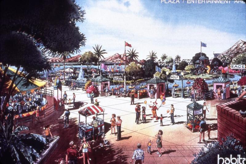
    <summary type="html"><![CDATA[<p><strong><em>How one Graduate course transformed the Salt River bed. </em></strong></p><img src="https://saltriverstories.org/files/fullsize/5ad2697108bc741514b02bd290cd0e76.jpg" alt="The Would-Have-Been Water Park" /><br/><p>In the fall of 1966 Professor Bob McConnell at Arizona State University (ASU) taught an eight-week class that would alter the Salt River bed forever. Class AC 429 tasked its students with one monumental chore: turn the then dry and troublesome salt river bed into something useful. From, “the Granite Reef Dam to the Gila River junction,” this channel of the salt river no longer flowed life into the surrounding agricultural areas, as the nearby areas had become massively urbanized, the need for the river lessened. Dams were put in place from 1911 through the 1940s in order to harness the power of the river into energy for the growing community along it.</p><p>James Elmore is commonly known as the original father of the Rio Salado project, which was the idea behind the class AC 429. When Elmore came to Arizona in the late 1940s all that was left of the salt river just north of ASU’s campus was a dry riverbed that was a dumping ground and an eyesore for the rest of the community. The dry river bed was also prone to flooding during Arizona’s finicky monsoon season, which was extremely problematic for the surrounding homes and businesses which were being built along the dry river bank. After a massive flood, just months before 1966, it was Elmore who raised the gauntlet in a challenge to the students of class AC 429, “Let’s do something with the river.” Elmore and the class proposed an oasis of sorts that would span for nearly forty miles across Arizona, it would offer the community a scenic drive, a resort-like park, hiking trails and various other amenities for which the area was lacking. </p><p>This plan was set in motion in 1966 but had to undergo various stages of approval before finally making it onto a ballot for all major municipalities involved. Throughout this process the idea for the area changed many times. Some options involved amusement parks, golf courses, marinas, stables, and other fun ideas for the area. But it wasn’t until 1979 that legislation started to be compiled to get this plan approved. But alas, in 1981 and again in 1987 the Rio Salado project was not approved throughout the region. Almost all of the municipalities voted no due to the rise in taxes it would cause. </p><p>The project and construction were put on hold until funding could be found to make it happen. In July of 1997 Tempe’s Mayor Giuliano officially signed the contract to commission Tempe Town Lake, a portion of the Rio Salado project but not the whole. The thought was that if Tempe began the project and showed that it could be done then other cities would follow suit. In August they broke ground on the project and it was completed in 1999 when water from the SRP canals flowed into the man-made lake. </p><p>Since Tempe Town Lake was constructed and filled, the banks surrounding it have been developed and given life to the surrounding town. The area has a thriving college life that actively uses the lake and various paths and trails on a daily basis. The lake was designed in a way that allowed for ASU to have a rowing team with a viable practice location. The business district is home to many companies that welcome and encourage ASU students in their quest for higher knowledge. Just like the dry river bed did for the AC 429 class in 1966.</p><p><em><strong><a href="https://saltriverstories.org/items/show/359">For more (including 5 images&#32;&amp;&#32;1 video) view the original article</a></strong></em></p>]]></summary>
    <published>2018-11-29T04:48:52+00:00</published>
    <updated>2026-04-17T19:35:32+00:00</updated>
    <link rel="alternate" type="text/html" href="https://saltriverstories.org/items/show/359"/>
    <id>https://saltriverstories.org/items/show/359</id>
    <author>
      <name>Nicole McCanless</name>
    </author>
  </entry>
  <entry>
    <title type="html"><![CDATA[Sun Devil Stadium: A Coming of Age for Arizona State University]]></title>
    <summary type="html"><![CDATA[<p><strong><em>Sun Devil Stadium grew with the University it supports.  As Arizona State University grew from a small teacher's college into the University it is today, likewise Sun Devil Stadium became a professional location for sports, concerts, and more.</em></strong></p><img src="https://saltriverstories.org/files/fullsize/9f3924d28cb6892c6728906f82fa6704.jpg" alt="Painting the Field" /><br/><p>In 1958 Proposition 200 passed in a statewide election by a 2-1 vote, and Arizona State College became Arizona State University.  Sun Devil Stadium opened that same year, and the team moved from the smaller Goodwin Stadium.  The new stadium opened with seating for 30,000 fans, twice the capacity of the 15,000-seat Goodwin Stadium.  Later renovations increased the size to nearly 75,000 seats.  In many ways, the construction of Sun Devil Stadium represented a coming-of-age for ASU.</p><p>University President Grady Gammage, who became President in 1933, led the statewide campaign to pass Proposition 200, through which the college became a full-fledged university.  Also, under his leadership, the school added the first Master's program and saw enormous growth in attendance.  The most significant increase in attendance occurred following World War II, primarily due to the GI Bill, when student populations increased across the United States.  For example, from a population of about 3,000 students in 1945, enrollments tripled to more than 10,000 by Gammage's death in 1959.  Increasing student populations allowed Gammage to secure federal funding for several new buildings to accommodate the students' needs, including Sun Devil Stadium and Grady Gammage Auditorium.</p><p>Naming the field at Sun Devil Stadium after former head coach Frank Kush in 1996 reveals another aspect of the stadium's history--the growing importance of college sports on campus.  Kush came to Arizona as an assistant coach for the Sun Devils in 1955 and was promoted to head coach in 1958.  He was also active in the drive to pass Proposition 200.  During his 22-year tenure as head coach, the Sun Devils only had one losing season.  The Sun Devils won several conference championships and the first three Fiesta Bowl Games.  Kush's legacy was not without controversy.  Kush was fired as coach in 1979 for interfering with an investigation into allegations of physical harassment of a former player.  He was found not liable, but in 1980 the NCAA punished ASU for multiple violations while Kush was coach.  </p><p>Sun Devil Stadium emerged as one of the most prominent sports venues in the Valley, contributing to the broader sports tourism industry with the inauguration of the Fiesta Bowl in 1971.  In the 1960s, then-President G. Homer Durham originally suggested the Bowl.  Eventually, a committee was formed to petition the NCAA.  The Fiesta Bowl was founded to ensure that Western Athletic Conference champions would have a bowl game to compete in after multiple years of champion teams, including the Sun Devils, on two occasions, were not invited to any major bowl games.  In 1968 Sun Bowl officials said they would ask the winner of the territorial cup (the game between ASU vs. University of Arizona).  Still, UofA insisted on an invitation ahead of the game, saying they would otherwise decline following their assumed victory against the Sun Devils.  The Sun Bowl organizers agreed.  The Sun Devils beat the Wildcats 30-7 in the game, which would have garnered them an invitation had the Wildcats not issued their ultimatum before the game.  In 1970 the Sun Devils were undefeated -  but were only invited to the Peach Bowl.  The Sun Devils have won five of their six Fiesta Bowl games, including the first three years of the Bowl.  The game was moved in 2006 to Glendale when the city created a larger, more modern venue to host the Arizona Cardinals professional football franchise.</p><p>Sun Devil Stadium also was home to Arizona's first professional football team.  In 1988 the stadium became the home of the Arizona Cardinals.  They would share the stadium with the Sun Devils until moving to their new facility in 2006.  Traditionally NFL teams wear uniforms in their colors during home games and white for away games.  The Cardinals did so for their first home game at Sun Devil Stadium then switched to wearing white at home during the warmer months so the opposing team would have to wear darker colors in the heat.  In 1996 Sun Devil Stadium hosted Super Bowl XXX.  The field was painted by ASU Athletics Facilities Maintenance Manager Peter Wozniak, who has painted the Sun Devil Stadium field prior to games since he was a student at ASU in the 1980s.  Following Super Bowl XXX, the NFL asked him to continue painting the field for pro title games.  He has done so internationally, spending about three weeks working on each field.</p><p>The Cardinals remained at Sun Devil Stadium much longer than anyone expected.  The Cardinals came to Arizona with an agreement that a dedicated stadium would be built for the team.  This would allow the organization to access revenue streams they were cut off from as a university tenant.  Funding for the new stadium was delayed due to the savings and loan crisis of the 1990s but was eventually approved by Arizona voters.  The original plan called for a new stadium in Tempe to take advantage of the existing infrastructure.  However, it was blocked due to the proximity of Sky Harbor International Airport.  The state-of-the-art stadium was built in Glendale, at the cost of $455 million, with over $300 million paid by the Arizona Sports and Tourism Authority and the city of Glendale.  Naming rights were awarded to the University of Phoenix for $154.5 million for twenty years.  However, they were terminated after eleven years due to financial problems at the for-profit school.  The new stadium also generates revenue from luxury skyboxes and outdoor concerts.  The 2018 Taylor Swift concert brought in over 7 million dollars for the team.</p><p>As a central venue for large events, Sun Devil Stadium also played an important role in regional music and arts.  In March 1976, a press junket and concert was held for the filming of Barbra Streisand's remake of "A Star is Born." The show was a full-day event featuring multiple artists, and several songs were filmed for the movie.  Other performers included her movie co-stars, Kris Kristofferson, Peter Frampton, and Santana.  The tickets were $3.50.  Part of The Rolling Stones' concert film "Let's Spend the Night Together" was filmed at Sun Devil Stadium in 1982, as well as some footage for U2's rockumentary "Rattle and Hum" in 1988.  In 1987 Pope John Paul II performed Mass at Sun Devil Stadium.  Before his visit, all images of Sparky, the Sun Devils mascot, were covered.  In 2009 President Barack Obama spoke at the Spring Commencement Ceremony, held at Sun Devil Stadium.  The University did not grant an honorary degree to the President during his visit, citing his lack of accomplishments at the time.  This caused some controversy prior to his visit, but Obama joked about it during his speech, saying his wife would agree with the statement and that he would "never pick another team above the Sun Devils in his NCAA bracket."  </p><p>Sun Devil Stadium has undergone several changes in recent years as it finds its place in the community with the move of the Arizona Cardinals to the newer stadium in Glendale.  ASU asked a group of student interns to come up with ideas on how to better utilize the stadium year-round, not just during Sun Devil games, and how to make it more profitable for the University.  It was due for renovations anyway -  the original construction did not use waterproof concrete because of the desert location.  What wasn't taken into account?  The water that was used for cleaning.  The stands were hosed down after each of the Sun Devil and Cardinal games, leading to rusting foundation supports.  Three phases of renovations totaling $307 million were done between seasons to minimize the disruption for the team, with the third finished in August 2018 before the first game of the season.  The renovations reduced the overall seating capacity to approximately 53,000, but combined the two student sections and connected the east and west sides of the stadium.  Now,  the entire stadium can be accessed from any entrance.  Amenities such as restrooms and concessions were also upgraded.  A new video board was installed, and a Student-Athlete Facility was constructed.  The University plans to use the stadium to host events year-round.  </p><p>edited 1/15/2020:wt</p><p>edited 10/18/2022: js</p><p><em><strong><a href="https://saltriverstories.org/items/show/358">For more (including 8 images) view the original article</a></strong></em></p>]]></summary>
    <published>2018-11-28T23:33:26+00:00</published>
    <updated>2026-04-17T19:35:32+00:00</updated>
    <link rel="alternate" type="text/html" href="https://saltriverstories.org/items/show/358"/>
    <id>https://saltriverstories.org/items/show/358</id>
    <author>
      <name>Rachel Stever</name>
    </author>
  </entry>
  <entry>
    <title type="html"><![CDATA[Rose Bowl Auto Court: The languish of a once iconic roadside oasis]]></title>
    <summary type="html"><![CDATA[<p><strong><em>From pioneering success to scandalous downfall: the rise and fall of a Phoenix roadside landmark.</em></strong></p><img src="https://saltriverstories.org/files/fullsize/f8780e3f4fdd01b72f6aa1598a233f25.jpg" alt="Lighting the Auto Court" /><br/><p>The Rose Bowl Auto Court, later renamed the Motor Court, was the prototypical automobile court of the 1930s.  Two wings of cottages, with adjacent carports, faced a long central courtyard with a lawn, palm trees, and a small swimming pool.  Its buildings were both heated and cooled (the first generation of air conditioning). Even better, the court was situated along Phoenix's East Van Buren Avenue, along which U.S. Federal Highways 60, 70, 80, & 89 flowed. The coast-to-coast highway brought the first generation of automobile tourists to the American west. </p><p>The owners of the Rose Bowl emerged as leaders in the Valley's early hotel industry.  In 1949, Michael Mikol (who purchased the property after World War II) helped to establish the Phoenix Chapter of the Arizona Motel Association which had the owners of 40 auto court hotels as charter members.  Elected as president of the organization, Mikol also represented Phoenix to the Arizona Motel Association, along with fellow hotelier Ralph Hawkins (who operated the nearby King's Rest Motor Court). The Phoenix Chapter sought innovative ways to lure guests to member hotels.  Groups like the Arizona Motel Association played a vital role in promoting tourism in the state and region.  In 1953, for instance, it began offering "western barbecues and square dances" for winter visitors to the city. Not only did it promote tourism but also worked to better the region. For example, according to the Arizona Republic, in 1949 the organization had a committee to investigate "smog, smoke, and dust in the air over Phoenix, and to aid in finding a remedy for the problem."</p><p>Mikol himself was the sort of entrepreneur who contributed much to the region and state's development. He was active in the region's cultural organizations. A Polish-German immigrant, Mikol belonged to a Polish social organization--the Pulaski Club of the Valley and the Orpheus Male Chorus, where he served as President. (The group performed at the 1961 dinner honoring Senator Carl Hayden at the Westward Ho Hotel, at which President Kennedy also spoke--see the Westward Ho entry for more details.)  He also expanded his business interests as the Rose Bowl prospered. In 1952, Mikol purchased the well-known Kohl's Ranch Lodge (in Payson); he dramatically expanded the property into "just about Arizona's biggest hotel-restaurant-resort," according to the Arizona Republic in 1965. </p><p>As local hoteliers hustled for business along the Van Buren, the Interstate Highway Act of 1956 would begin a decades-long process of remaking American roadways. In Phoenix, plans for Interstate 10 through the downtown were introduced in 1960 but would not be completed until 1990.  Promoted by commercial interests and political leaders, opposition mounted on a variety of fronts, including location (too far south of the central arteries of Phoenix, such as Van Buren Avenue), environmental concerns, and concerns about the loss of historic neighborhoods.  </p><p>Although the construction of the Interstate languished, hotel owners along Van Buren discovered that investment along the road was harder to obtain.  Coupled with a growing reputation for crime--including especially prostitution and drugs--local business owners banded together in the East Van Buren Parkway Association to promote the street, to improve the landscape, and to thwart gradual decline that accompanied changing consumer tastes and driving habits. </p><p>In about 1980 the Rose Bowl was acquired by a corrupt businessman who would acquire more than a dozen properties along East Van Buren, allowing them to languish to the point of becoming unlivable. After the owner was convicted of theft and fraud in 1985, the Rose Bowl (as well as the Lazy A next door) were sold at auction by the state of Arizona.  In 1992, the Salvation Army purchased the lots adjacent to Rose Bowl (the Desert Hills & the Seabreeze) and built its new regional headquarters along Van Buren--part of an ongoing effort to remake and redevelop the once-vital commercial street. </p><p><em><strong><a href="https://saltriverstories.org/items/show/355">For more (including 7 images) view the original article</a></strong></em></p>]]></summary>
    <published>2018-06-06T21:35:07+00:00</published>
    <updated>2026-04-17T19:35:32+00:00</updated>
    <link rel="alternate" type="text/html" href="https://saltriverstories.org/items/show/355"/>
    <id>https://saltriverstories.org/items/show/355</id>
    <author>
      <name>Mark Tebeau</name>
    </author>
  </entry>
  <entry>
    <title type="html"><![CDATA[Patton&#039;s Grand Theater: The Parisian Palace of Phoenix]]></title>
    <summary type="html"><![CDATA[<p><strong><em>Just like the Phoenixes on the entrance marquee, Patton’s Grand Theater rose from the ashes of potential destruction and changing management many times before inevitably falling in 1985 to urban revitalization. </em></strong></p><img src="https://saltriverstories.org/files/fullsize/a8fdeb97a0c6c576966008b8cdff07dc.jpg" alt="Ceiling Mural" /><br/><p>The 1898 Queen Anne-style theater, located at 300 West Washington Street in Downtown Phoenix, was originally constructed by architect S. E. Patton for nearly $35,000 (nearly $1 million today) and boasted conical towers, 20 bay windows, accommodations for 1,200, and the largest known state on the west coast. </p><p>A critic wrote of their preview of the theater in 1898, “The prevailing tint throughout is a delicate pale green, and when lighted by 384 brilliant electric lights, the scene is one of vast and unlimited confusion, until one becomes reconciled, when the beautiful frescoes that so profusely embellish the walls and ceiling stand out as clear as if in relief. Elaborate greenish portieres form the background of the loges, while the handsome gilded Chinese curtains that drape the windows yield the finishing touch to this Parisian palace of Phoenix.”</p><p>On December 16, 1899, Patton’s Grand Theater managed to make headlines across the country. During a production of Don Caesar, the chorus, armed with muskets and supposed black cartridges, found themselves shooting small missiles intended for target practice into the cast. The shooting severely injured actor Paul Gilmore, who took six shots, and actor Lewis Monroe died of wound complications. “The Great Gilmore Massacre,” as the event was ultimately named, left many wondering if Gilmore’s theater troupe was jinxed. Just a few days later, actress Kathrine Kidder fainted on stage due to extreme exhaustion, severely hitting her head on the stage floor.</p><p>Nearly two weeks after the Great Gilmore Massacre and 14 months after its opening, S. E. Patton sold the theater to E. M. Dorris and renamed the Dorris Opera House. Over time, however, the term “opera house” was exchanged for “theater”, as the building was never truly constructed for operatic concerts. Many of the first Salt River Valley Water Users’ Association meetings were held within the Dorris Theatre from 1899 to 1901, forming what is now known as the Salt River Project. By the early 1910s, the theater renamed itself once again as the Elks Theatre, hosting Elks club meetings upstairs, and varying performances downstairs, including the play the Pirates of Penzance, bandleader John Phillip Sousa in 1915, and even D. W. Griffith’s film Birth of a Nation. Come the Great Depression, the theater took on the name the Apache, and by the 1950s, again renamed itself as the Phoenix Theater and served as a movie theater until 1965.</p><p>By 1984, the twin conical towers iconic to the theater had disappeared, and many of the bay windows had been bricked in. The atypical pink plaster was a remnant of the past, cracking off with each passing day. Inside, little remained of the then state-of-the-art seating, and the glamorous frescos on the ceiling were instead covered in political posters. At the time of its destruction in 1985, the Dorris Opera House served as a municipal annex for city clerk election materials rather than a theatrical paradise. Many parties attempted to preserve the theater over the years to no avail, including Phoenix Mayor Terry Goddard. However, the cost to restore the historic building—estimated at over $1 million—proved to be too steep for Arizona preservationists. Director of the Central Phoenix Redevelopment Agency Jim Forsberg stated in 1984 that if any buildings were to be redeveloped in the Downtown Phoenix area, the Palace West—now known as the Orpheum—was significantly more suitable.</p><p>Today, in place of the once great Patton’s Grand Theater, stands the Phoenix Municipal Court: one of the top ten busiest municipal courts in the United States. While the architectural significance of the 19th-century style theater is now lost to photographs and distant memories, the Orpheum, built just 30 years after Patton’s, remains on Adams Street, preserving some memory of early Phoenix theatrical history.</p><p><em><strong><a href="https://saltriverstories.org/items/show/339">For more (including 5 images) view the original article</a></strong></em></p>]]></summary>
    <published>2018-04-17T21:43:31+00:00</published>
    <updated>2026-04-17T19:35:31+00:00</updated>
    <link rel="alternate" type="text/html" href="https://saltriverstories.org/items/show/339"/>
    <id>https://saltriverstories.org/items/show/339</id>
    <author>
      <name>Sierra Stewart</name>
    </author>
  </entry>
  <entry>
    <title type="html"><![CDATA[Interning the Japanese: Gila River Concentration Camp]]></title>
    <summary type="html"><![CDATA[<p><strong><em>During World War II, the United States forcibly moved Japanese Americans to camps in the Arizona desert.</em></strong></p><img src="https://saltriverstories.org/files/fullsize/5f9d016430160c0a05967583b5029feb.jpg" alt="Gila Barracks" /><br/><p>On February 19, 1942, President Franklin D. Roosevelt signed Executive Order 9066 which gave permission for the War Department to relocate Japanese and Japanese-Americans living in the western United States to concentration camps. In March 1942, with the aid of US Census data and military support, the newly minted War Relocation Authority (WRA) forcibly moved more than 100,000 people into hastily conceived “evacuation” camps.</p><p>In Arizona, the hurriedly constructed Poston and Gila River Centers emerged: the Poston camp near the town of Poston in the Colorado River Indian Reservation, and Gila River camps south of Phoenix in the Gila River Indian Community. Built on Native American reservations, without the approval of Tribal Governments, the Gila River camps took only a few months to construct. Although the Gila River Indian Tribal Council rejected the Federal Government’s proposed lease twice, it narrowly approved the contract and the occupation of the land by the WRA camps. The lease agreement indicated that in lieu of payment, the WRA agreed to cultivate 8,500 acres of tribal land--a commitment the WRA never completed. The camps at Gila River came to be known as the Rivers Camps--named after Jim Rivers, the first Akimel O'otham killed in the First World War. </p><p>Canal Camp opened in May of 1942. Several hundred uniformly constructed tile roofed wood structures were to be the homes, offices, and entertainment spaces for approximately 14,000 people over the course of the next three years. </p><p>No insulation or air cooling units were provided to the majority of the structures, along with rudimentary furnishings. The barracks buildings were 20 x 100 square feet, with each building separated into four apartment rooms, each room large enough to house 3 to 4 people as a family unit. </p><p>As the smaller of the two Rivers camps, Canal was only intended to house 5,000 people. As soon as the camp was complete, approximately 6,700 internees were transported by train from the Turlock Assembly Center near San Francisco to the town of Casa Grande. The train cars available were old and frequently had no air conditioning or other comforts. Internees were then crowded into old buses and trucks for the 16-mile trip from the train station to Canal Camp. With only a few vehicles available, multiple round trips had to be made from train to camp, leaving those on the trains under armed military guard during the heat of the day to wait for the last leg of their journey. </p><p>Conditions were miserable. Water, gas, and electricity shortages plagued Canal Camp throughout the summer. Dust storms and monsoons were common through the hottest months and the overcrowded population struggled to adapt. Summer daytime temperatures soared, regularly exceeding 100 Fahrenheit through the months of July and August. </p><p>With little relief from the scorching heat, some internees dug out cellars under their barracks while others collected scrap materials and built rudimentary evaporative “swamp” coolers they installed onto the buildings. Ice water was supplied from the mess halls through a spigot sticking out of the wall. Ice was in short supply, so mess hall workers would put ice blocks inside the drinking water tank allowing a supply of cool drinking water without risk of the ice being stolen. </p><p>Many of the internees were farmers from California. While unfamiliar with the climate and soil of the Arizona desert, they worked with local farmers and learned to grow vegetables. With plenty of open land and access to the Gila River water from a nearby canal (for which the Canal camp is named), a successful agricultural program developed. By mid-1943 local newspapers reported that Rivers camps produced about $1 million worth of food, the majority of which supplied fresh produce to camps throughout the US. As a result of the camp’s farming success, a drying plant was created to preserve excess produce and was added to the list of camp-based industries. </p><p>Over the first year, the Rivers camps were praised repeatedly in local papers for their successful industries. The US Navy praised a small plant of 50 men at the camps for their efficient model ship manufacturing plant. Turning out around 100 ships per month, the models were used by the military in training exercises. </p><p>Over time, conditions in the camps improved, largely through the coordination and efforts of the internees themselves. With the relative freedom to self-govern inside the camp, block councils were developed to focus on day-to-day issues. A leadership council consisting of one representative from each block also convened for the purpose of working with the administration. Also, administrators of the camp hired internees to organize recreational activities. A library and school provided limited educational opportunities and a movie theater and a baseball diamond provided entertainment and recreation. The community planned festivals and events; they organized church services, theater groups, scout troops, and women’s clubs. Such activities fostered a sense of community for the interned Japanese Americans. </p><p>Playing sports became a very important pastime, with baseball being a particular favorite. Kenichi Zenimura, a baseball player who set about building a baseball diamond on a vacant patch of land at the camp, became instrumental in developing a 36 team league in camps throughout the country. His passion for baseball and his influence in the community earned him the title Father of Japanese-American baseball. A memorial to him and the league stands at Nozomi Park in Chandler, AZ. </p><p>In 1943, as a response to continued accusations of special treatment by the WRA, First Lady Eleanor Roosevelt visited Rivers camps to see the conditions for herself. She found the conditions uncomfortable and commended the internees on their resourcefulness. Not long after her visit, she began campaigning to disband the internment camps as soon as possible. The First Lady’s campaign was not well received by many, including Arizona’s congressional representatives. </p><p>Because the Military Zone 1 was designated the coastal states, if released, the internees would be unable to return to their homes. As alternate resettlement plans were discussed many Arizona residents, spurred by prejudice and fear, became distressed over the prospect of Rivers internees settling in Arizona. As a result, an appeal was made to the Undersecretary of War by Senators Carl Hayden, E. W. McFarland, and Representatives John R. Murdock and Richard F. Harless, requesting that Arizona be added to the Military Zone 1, thus blocking Japanese-Americans from settling within the state’s borders, citing a possible risk of violence. </p><p>In the end, the camps did not close until after the war was over. By November 16, 1945, all Japanese-Americans who had been incarcerated in the Rivers camps had returned to their home states to rebuild their lives only to find their homes and businesses sold off. The buildings and all reusable materials were removed from the camps, leaving little of value and broken concrete slabs behind, making the sites difficult for the tribes to redevelop. Former internees erected a memorial, but access to the site is limited. As the Gila River Indian Reservation holds sovereignty over the land, permission must be granted before visiting. In 2001 the US Park Service recommended an off-site memorial be erected to commemorate those Japanese-Americans who died in World War II, as well as those who survived the harsh years in captivity in Arizona. An official Federal monument has yet to be built.</p><p><em><strong><a href="https://saltriverstories.org/items/show/338">For more (including 6 images&#32;&amp;&#32;3 videos) view the original article</a></strong></em></p>]]></summary>
    <published>2018-04-17T20:43:42+00:00</published>
    <updated>2026-04-17T19:35:32+00:00</updated>
    <link rel="alternate" type="text/html" href="https://saltriverstories.org/items/show/338"/>
    <id>https://saltriverstories.org/items/show/338</id>
    <author>
      <name>Wendy Trakes</name>
    </author>
  </entry>
  <entry>
    <title type="html"><![CDATA[Building South Mountain: The CCC and the Landscape of the New Deal]]></title>
    <summary type="html"><![CDATA[<p><strong><em>In an effort to ease economic issues during the Great Depression, the federal government created the Civilian Conservation Corp (CCC) through the New Deal. The CCC was dedicated to employing young men for public improvement projects, such as constructing roads and public parks. Some of these projects were right constructed right here in Arizona.</em></strong></p><img src="https://saltriverstories.org/files/fullsize/48664463e249d488477746baef281700.jpg" alt="Heartache in the Great Depression
" /><br/><p>The Great Depression had a profound impact on the United States as well as greater Phoenix. In an effort to confront the economic and social costs of the Depression, President Franklin D. Roosevelt argued for a New Deal in which the federal government sought to put Americans back to work through building infrastructure and other vitally needed public projects. Among the programs he created was the Civilian Conservation Corps (CCC). The immensely popular program created jobs as recruits built facilities, roads, and other structures in hundreds of parks nationwide. This included both state and National Parks. In Phoenix, the CCC constructed buildings, performed landscaping, and excavated rocks at South Mountain leaving a visible imprint of the New Deal in the landscape.</p><p>Established in 1933 the CCC sought to put Americans back to work and to improve the health and morale of poor young men by taking them out to the countryside to do work. Over its nine years of existence, the CCC employed more than 3 million men, approximately 5 percent of the total U.S. male population. Recruits were 17 to 24 years old; they earned 30 dollars a month and served for 6-month intervals. Corps members worked for a maximum of two years. Young men earned a decent paycheck, learned valuable life lessons, and reshaped the American landscape in the process. In particular, the CCC made large contributions to National Parks.</p><p>In Phoenix, the CCC played a significant role in building the infrastructure in South Mountain Park, which is located along the city's southern boundary. South Mountain Park was established in 1924 when the City of Phoenix purchased an area known as the Salt River Mountains. The city’s primary goal in setting aside the 14,500-acre parcel was to save the land from private development.</p><p>From 1933 through 1940, more than 4,000 men worked at two camps in the park. The camps generated about $5,000 in money for the local economy, as most of the materials and supplies were purchased locally. Also, most of the young recruits spent their $5 allowance in the city. The CCC made the park accessible to Phoenicians; they built some 40 miles of hiking and horse trails, 26 miles of road, scores of fire pits, and more than 30 buildings, ramadas, and other features--including a museum building in 1934. Like the Park's other buildings, the building was designed collaboratively by the National Park Service and the City Parks Supervisor. The South Mountain Park entry complex was added to the National Register of Historic Places in 2014, some 70 years after it was built.</p><p>Former enrollees of the CCC formed a national alumni organization in 1977. In 1981, an Arizona chapter was established, which went on to dedicate three monuments to their efforts in Arizona. Statues were erected at Colossal Cave Mountain Park in 2008 and in South Mountain Park in 2009. The chapter also placed a granite monument with a plaque to the CCC's efforts in Wesley Bolin Plaza in 1990.</p><p><em><strong><a href="https://saltriverstories.org/items/show/337">For more (including 7 images) view the original article</a></strong></em></p>]]></summary>
    <published>2018-04-17T20:32:24+00:00</published>
    <updated>2026-04-17T19:35:32+00:00</updated>
    <link rel="alternate" type="text/html" href="https://saltriverstories.org/items/show/337"/>
    <id>https://saltriverstories.org/items/show/337</id>
    <author>
      <name>Tyler Cervenka</name>
    </author>
  </entry>
  <entry>
    <title type="html"><![CDATA[Hohokam Canals: Ingenious Engineering and Lasting Impact]]></title>
    <summary type="html"><![CDATA[<p><strong><em>The Hohokan people dug a sophisticated network of canals in the Salt River Valley as a foundation for a flourishing civilization. With a population estimated to be as many as 80,000 individuals at its height, the culture flourished for more than 1000 years in the unforgiving Sonoran desert before disappearing in about 1450 CE.</em></strong></p><img src="https://saltriverstories.org/files/fullsize/ad1a1765ae3b64cff7e156dfb19e578a.jpg" alt="An Irrigation Scene" /><br/><p>The Hohokam people lived in the Mesa area for nearly 1,500 years. Hohokam, (a Pima Indian word meaning ‘‘those who have disappeared’’), first appeared around 1 CE initially growing beans, squash, corn and cotton serving a very small population of less than one thousand. Around 600 CE, the Hohokam population grew too large for sustainable living. As the population grew further from the river, the Hohokam began to construct canals for irrigation. Using digging sticks, the Native Americans excavated 12 foot deep canals, fanning into a larger network of smaller canals.</p><p>Because of their extensive excavation abilities, the Hohokam were considered to be engineering geniuses. Their ability to push water effectively for several 100 miles over a flat desert landscape, while evading hills and valleys complimented their legacy. Creating a stabilized canal system they transported water through minimal changes in elevation and overcame natural ebbs and flows that rivers create.  In areas of excessive water(flow), the Hohokam would widen the channel. In areas of inadequate water(ebb), the channel would be narrowed, increasing velocity of water.  This increase in velocity, decreased sediment buildup, discharge into fields and evaporation.  If they allowed the water to stagnate, those three elements occur.  </p><p>To maximize potential of water to exit the river into canals, the Hohokam developed several techniques. A weir, or partial dam, forced water into the headgate of the canal, creating maximum force, and more efficiently carrying water to the local farms. The headgates were made out of wood and giant rocks, withstanding the river's immense strength.  The Hohokam canal stretched nearly 500 miles and would serve up to 50,000 natives at any given time. There is no universally accepted evidence on why they disappeared, only speculation. The most viable reason was outgrowing their capacity to sustain life in the desert. Especially during periods of environmental stress, all but vanished by 1450.</p><p>The Hohokam effort to build irrigation canals became the foundation of economic and urban development of Arizona. Jack Swilling, a Mexican War and Confederate States Army Veteran, headed west in the late 1850s to work as an ox-train teamster. Ten years later, a central Arizona gold rush brought many miners near the Salt River. Needing a constant supply of water, the miners and soldiers observed the landscape.  Upon discovering the Hohokam canals, Swilling analyzed their potential and restored them as a viable water delivery source. With sixteen other miners, he received a loan to create ditches, minimizing watershed, to successfully raise wheat, barley and corn.  He redirected the delivery of water from the Salt River via the canals and ditches (modern day 32nd Street and Van Buren Street), to sell to miners in Wickenburg and infantry stationed at Ft. McDowell. The Swilling Irrigating Canal Company, as his company came to be called, revitalized the irrigation system and enticed more people to settle in the area. Englishman ‘‘Lord’’ Darrell Duppa, recognized the symbolism of a new agricultural civilization rising from old  Hohokam canals. He said: ‘‘A city will rise phoenix-like, new and beautiful, from these ashes of the past,’’ and renamed the new community Phoenix.” </p><p>Around the 1880s, Charles T. Hayden, father of Carl, was an early Arizona settler who observed the many farmlands the canals serviced and was also compelled by the success of Swilling Irrigation and Canal Co. On a business venture, Charles was on a freighting trip to Wickenburg when a severe storm and flooding of the Salt River forced him to wait several days. The delay gave opportunity to examine the surrounding land, where he envisioned a thriving agricultural community. As the foundation for the farming was laid out, Charles observed corn and vegetables successfully growing by the Swilling ditch. With an increase in settlers and an entrepreneurial mind, he began to entertain the idea of a gristmill.         	</p><p>Nearing the end of the nineteenth century, local promoters recognized that a more stable water supply was needed to continue population and economic growth. With high variable flows, the Salt River, and many rivers alike, were subject to very low flows followed by substantially large floods. There was also a substantial amount of water loss that was a pressing issue. In 1891, flood waters raged through the heart of the agricultural valley, destroying irrigation headgates and canals. One local resident commented: ‘‘Chocolate in color, hideous in its roaring fury, the torrent spared nothing in its path.’’  The floods were followed by a severe drought between 1898 and 1904, resulting in the loss of thousands of crop acres. Men would patrol the river with rifle in hand, ensuring locals were not taking more than their fair share.  But from this environmental near-disaster came a successful regional movement to build an upstream dam to retain, stabilize and protect the area from flooding.</p><p>Carl Hayden was directly affected by this flooding and witnessed his father's business take a substantial loss. Fighting for his father's vision, he traveled to Washington to lobby for the Salt River Project as Congress debated the Federal Reclamation Act in 1902. He was Arizona's primary influence on federal policy making in natural resource development, water reclamation, and land-use management. Due to his vision and effort, Carl is considered Arizona's most important individual in reshaping it from a pioneered settlement to a modern urban state.  </p><p>Tonto Basin became the ideal location for a dam, but securing the finances to build it would prove difficult. Local ranchers and farmers created the Salt River Water Users Association (SRWUA). They pledged their lands as collateral to obtain a loan large enough to allow the building of the Tonto Basin and Roosevelt Dam. In 1902 a National Reclamation Act was passed into law allowing government loans to reclaim the West with irrigation projects. By creating the Theodore Roosevelt Dam and improving existing Hohokam canals, the government sought to improve water retention and delivery velocity of water by modernizing the canals. They did this by laying cement and replacing the head gates with a more reinforced cement delivery.  </p><p>SRWUA would restore Canals and build dams by the use of hydroelectric generators. The generators allowed the government to slowly pay the local farmers for their investment.  In 1917 the operation of the canal system was turned over to the Salt River Water Users Association, later developed into Salt River Project (SRP). The SRP succeeded in supporting a growing population. Receiving government loans, during the next 30 years, SRP would erect the following dams and canals respectively: Mormon Flat Dam in 1925, Mesa Dam in 1927, Stewart Mountain Dam in 1930, Bartlett Dam in 1939, Horseshoe Dam and Sixth Storage Dam, 1946. These dams allowed for maximum water retention and manageable delivery. The canals that SRP created are, The Grand Canal (22.43 miles), Consolidated Canal (18.95 miles), Eastern Canal (14.73 miles), Western Canal (13.61 miles), South Canal (9.91 miles), Tempe Canal (9.76 miles), and New Crosscut Canal (3.4 miles), serving more than six million today.  </p><p>While the canals were technically created to deliver water to a desert metropolis, they have historically been associated with recreation as well. Being considered a part of Arizona’s social fabric, the canals were popular places for walking, running, biking and horseback riding. Reducing the need for heavy equipment, SRP released white amurs, a kind of Asian carp. This cleaned up the moss and weeds that were associated with dirtying the water with algae. The Arizona Canal, near Scottsdale, displays art, holds special events, and contains pedestrian bridges, landscaped walkways and easy access to canalside shops and restaurants.</p><p><em><strong><a href="https://saltriverstories.org/items/show/336">For more (including 6 images) view the original article</a></strong></em></p>]]></summary>
    <published>2018-04-17T20:26:12+00:00</published>
    <updated>2026-04-17T19:35:32+00:00</updated>
    <link rel="alternate" type="text/html" href="https://saltriverstories.org/items/show/336"/>
    <id>https://saltriverstories.org/items/show/336</id>
    <author>
      <name>Troy Valdez</name>
    </author>
  </entry>
  <entry>
    <title type="html"><![CDATA[Hayden House: La Casa Vieja]]></title>
    <summary type="html"><![CDATA[<p><strong><em>Hayden House, also known as La Casa Vieja, is the longest-standing adobe structure in Arizona, having been erected in 1873. </em></strong></p><img src="https://saltriverstories.org/files/fullsize/5435974b6bf566ddd2bbd9f0189e190e.jpg" alt="Charles Hayden &amp; Workers" /><br/><p>The Hayden House, or La Casa Vieja as it came to be known, is the longest-standing Mexican-adobe structure in Arizona.  It was originally constructed in 1873 near the South bend of the Salt River by local Mexican and indigenous craftsmen for Charles Trumbull Hayden.  "The original house was a single-story row house constructed of adobe in the Sonoran style," according to the City of Tempe.  With an "L" shape, the house fronted Mill Avenue for 80 feet and First Street (now Rio Salado Parkway) for 120 feet. </p><p>Charles Hayden settled in Tempe after he relocated his freighting business and implemented plans to build a flour mill.  In 1877, Carl Trumbull Hayden was born inside the Hayden House, where he and his two sisters, Sally and Mary, grew up.  The Hayden House was refurbished throughout 1876-1883 by adding three more rooms to the west side and a second story of adobe on the north end.  Throughout the life of the old house, it has always served as an epicenter for the growing community.  </p><p>In 1889, when the Hayden family moved to a larger ranch north of the Salt River, they added a wood-framed second floor to the simple adobe structure.  The former Hayden residence became a boarding house and general store and remained so for more than thirty-five years.  Recognizing the structure's historical importance,   Sally and Mary Hayden commissioned what was arguably the first historic restoration and preservation project in Arizona.  Hoping to maintain the original adobe design, they hired noted local architect Robert T. Evans, who often worked in building and renovating adobe buildings, to restore the property.  The Haydens converted the house into a restaurant that became known as La Casa Vieja: "the old house." </p><p>In 1954 Leonard Monti purchased La Casa Vieja from Sally and Mary Hayden, who were forced to sell due to debts accrued during the Great Depression.  Leonard Monti understood the importance of the old house to the area and kept the name.  The Monti family operated the restaurant from 1956 until 2016.  The family honored the house's history and incorporated pictures from 1920 into the menu.  Monti also gave historical tours of the Hayden House.  The house's location was significant because of the amount of traffic that flowed through Downtown Tempe, where Federal Highways 60-70-80-89 converged to cross the Salt River at the Mill Avenue Bridge.  In 1979, La Casa Vieja continued to expand on the southern end of the building.  Eventually, though, the interstate highway, suburban expansion, and rising land values in downtown Tempe created economic pressures that led the Monti family to sell La Casa Vieja in 2014.</p><p>Current plans call for a new multipurpose office and lifestyle hotel at the location, with plans to save the original Hayden House and incorporate it into the facility.</p><p>edited 10/20/2022: js</p><p><em><strong><a href="https://saltriverstories.org/items/show/332">For more (including 10 images&#32;&amp;&#32;2 audio files) view the original article</a></strong></em></p>]]></summary>
    <published>2018-04-17T19:53:55+00:00</published>
    <updated>2026-04-17T19:35:31+00:00</updated>
    <link rel="alternate" type="text/html" href="https://saltriverstories.org/items/show/332"/>
    <id>https://saltriverstories.org/items/show/332</id>
    <author>
      <name>Kade Krauss&amp;#32;&amp;amp;&amp;#32;Jacquelyn George</name>
    </author>
  </entry>
  <entry>
    <title type="html"><![CDATA[Crossing the Salt River: Modest Ferry to Urban Bridge]]></title>
    <summary type="html"><![CDATA[<p><strong><em>Looking at the Salt River on a map today, the vast water source is now merely drybed. What little water remains hardly resembles the great and powerful rapids of the past. For the early settlers of the Arizona territory, finding methods of crossing this waterway during high waters was a challenge for travelers and traders alike.</em></strong></p><img src="https://saltriverstories.org/files/fullsize/9004b4151715feeb9f7206ed334cfd49.jpg" alt="In Operation" /><br/><p>Charles Trumbull Hayden came to the western half of the United States in search of economic gain and adventure like the many settlers before him.  Shortly after the Gadsden Purchase in the 1850s, Charles Hayden opened a profitable general store in southern Arizona next to the settlement of Tubac.  On a freighting business trip from Tucson to Prescott, high water from a heavy storm near the Salt River in present-day Tempe halted Charles' journey for several days.   Inspired by the Swilling Irrigation and Canal Company's success and visions of a thriving agricultural community, Charles Hayden decided to set roots and purchase 160 acres of land in the region in 1870.  He established a homestead named Hayden's Ferry, which included a grist mill, general store, blacksmith, and ferry. </p><p>The ferry was one of the only ways to cross the Salt River for travelers during flood season for a modest price and provided its services until the early 1900s.  However, Charles Hayden's ferry was relatively inconsistent, as the dramatic rains of the desert would either bring impassable water rapids or no rain at all.  As the owner of a freighting business, Charles Hayden still needed a reliable way to transport his goods, so the ferry remained in service until a better solution came forward.  A viable option for crossing the Salt River during floods finally arrived with the creation of the Roosevelt Dam in 1911.  The dam brought forth the ability to maintain  - and somewhat manage -  the rapids of the Salt River and subsequently helped to increase agricultural irrigation control and water retention in the Valley region.  In many ways, the creation of this dam was emblematic of the economic, political, and population growth experienced in the area. </p><p>In 1911, Governor George W.P. Hunt commissioned the construction of what would be later known as the Ash Bridge as one of the only sources of crossing the Salt River during heavy floods.  Using the designs drawn up by Arizona's first territorial engineer, J.B. Girand, work began constructing the bridge immediately.  During this construction period, the public remained uneasy about the controversial decision to use a convict labor force to cut costs.  Still, Governor Hunt assured the people of Tempe that if even one convict escaped, he would step down as Governor of Arizona.  Fortunately for  Hunt, there were no successful attempts to flee, and the convicts proved excellent workers in completing the project.  In 1913, Ash Bridge was officially open to the public for use as the primary crossing of the Salt River.</p><p>While Ash Bridge served as Arizona's first highway bridge to cross the river and a solid passage form for walking pedestrians and wagons, its design was almost immediately outdated due to technological advancements.  As automobiles grew heavier and wider, the narrow design effectively made a functional two-lane bridge impossible.  This,  coupled with a massive flood in 1916, which left the bridge's structural integrity in question, forced town leaders to close the bridge to all but pedestrian traffic.  The fledgling city desperately needed a new solution.  Within two decades, a push for a much broader and stronger bridge began that would soon leave Ash Bridge as a deteriorating asset to the city.</p><p>Around 1928, the most considerable push for a new bridge came from a group of Tempe businessmen who submitted a formal request to the Arizona Highway Commission.  In the following year, with the designs drawn up by Arizona bridge engineer Ralph Hoffman, the construction of the Tempe Bridge, now known as the Mill Avenue Bridge, began.  The bridge opened to traffic in the summer of 1931 after two years of construction.  Two years later, Benjamin Baker Moeur, the 4th Governor of Arizona and prominent physician held and presided over a two-day dedication ceremony.  Located in the exact location that Hayden's ferry had operated around 60 years prior, the bridge easily handled two-way automobile traffic - and all of the flooding rain that the Arizona climate could provide. </p><p>An essential element of the Mill Avenue Bridge, which contributed to the growth of the city,  was the fact that it had now connected the transcontinental highways of the U.S. 60, U.S. 70, and U.S. 80 to Tempe, along with Arizona's only north-south route, U.S. 89.  The newly formed interconnectivity of Arizona's highway systems crossing over the Salt River created easier travel opportunities for individuals all over the country, and it was pivotal in the development of the city of Tempe and the surrounding Phoenix Metropolitan Area.  However, in the following decades, the single two-lane bridge slowly became inefficient for the population, quickly outgrowing its narrow system.  As a result, an additional parallel bridge was completed in 1994 to relieve the increasing traffic. </p><p>Since the days of Hayden's Ferry, Tempe's inventiveness has introduced the prosperity Charles Hayden dreamt of during his time at Hayden's Ferry.  Hayden opened the door for development and successful commerce in the region with his ferry. Since then, it has only expanded.</p><p>edited 10/20/22: js</p><p><em><strong><a href="https://saltriverstories.org/items/show/328">For more (including 4 images&#32;&amp;&#32;1 audio file) view the original article</a></strong></em></p>]]></summary>
    <published>2018-04-12T21:16:30+00:00</published>
    <updated>2026-04-17T19:35:31+00:00</updated>
    <link rel="alternate" type="text/html" href="https://saltriverstories.org/items/show/328"/>
    <id>https://saltriverstories.org/items/show/328</id>
    <author>
      <name>Austin Keating</name>
    </author>
  </entry>
  <entry>
    <title type="html"><![CDATA[Frank Lloyd Wright Spire: The Capitol that Never Was ]]></title>
    <summary type="html"><![CDATA[<p><strong><em>On April 5, 1957, Frank Lloyd Wright presented a sketch for the new Arizona State Capitol, which included spires and a grand landmark.  Finally, in 2004,  his design was finished and created to fulfill his dream.</em></strong></p><img src="https://saltriverstories.org/files/fullsize/d45d9814dc9b2c2c275919122225ea74.jpg" alt="View From the Fountain at The Scottsdale Promenade " /><br/><p>In 2004, a defining piece of Frank Lloyd Wright's 1957 state capitol design rose in the Promenade shopping center in Scottsdale, Arizona. The shopping center desperately needed a focal point, and Frank Lloyd Wright's protégé, Arnold Roy, was happy to oblige. Wright's original design never graced the Capitol but Roy, who was Wright's apprentice during the controversial Oasis project, suggested it for the Promenade. </p><p>The 125-foot turquoise spire boasts 1,700 pieces of steel and weighs over 75,000 pounds. Its glowing, electric blue point can be seen in the distance across the North Valley. The corner of Scottsdale Road and Frank Lloyd Wright was the perfect spot for the piece to debut. The spire's hue is true to Wright's consistent use of natural colors that relate to the surrounding landscape and is unmistakenly an ode to Arizona's ubiquitous and world-renowned turquoise. </p><p>The Frank Lloyd Wright Spire is a tribute to the renowned architect's influence on the Valley of the Sun and the Capitol that never was.</p><p><em><strong><a href="https://saltriverstories.org/items/show/299">For more (including 3 images) view the original article</a></strong></em></p>]]></summary>
    <published>2018-01-11T20:12:12+00:00</published>
    <updated>2026-04-17T19:35:31+00:00</updated>
    <link rel="alternate" type="text/html" href="https://saltriverstories.org/items/show/299"/>
    <id>https://saltriverstories.org/items/show/299</id>
    <author>
      <name>Sierra Stewart&amp;#32;&amp;amp;&amp;#32;Jennifer Schaper</name>
    </author>
  </entry>
  <entry>
    <title type="html"><![CDATA[The Oasis: Frank Lloyd Wright&#039;s Enduring Legacy]]></title>
    <summary type="html"><![CDATA[<p><strong><em>Wright's five million dollar design for the Arizona State Capitol never broke ground, but his legacy lives on in the Valley of the Sun. </em></strong></p><img src="https://saltriverstories.org/files/fullsize/d7851b6448c4621c31d2a846b1d663b2.jpg" alt="The Oasis" /><br/><p><span>Architect Frank Lloyd Wright saw great potential within the vast Sonoran Desert. The designer had just finished the designs of his renowned Usonian homes when he found himself deep within the McDowell Mountains of Arizona. In 1937, after ten years of exploring what architectural historian Edgar Kaufmann refers to as "his Arizona desert experiments," Wright constructed the National Historic Landmark Taliesin West. </span>

<span>Wright's passion for the desert landscape continued to influence the surrounding area beyond Taliesin West. Sixteen years after the winter home's inception, in February of 1953, American Institute of Architects Phoenix division speaker and architect Fred M. Guirey shared his desire to modernize the Arizona State Capitol by moving to Papago Park in Tempe, Arizona, during a Valley of the Sun Kiwanis Club's Hotel Westward Ho luncheon. That same month, Wright shared his agreement with the move at another meeting and in March of 1955 -- over two years later -- spoke again during a Phoenix Press Club meeting. </span>

<span>On January 25, 1957, the Arizona Republic carried a photograph of a new state capitol proposition. Lloyd Clark, a Phoenix Gazette reporter, shared the 20-story building design with Wright in an interview a month later. So dissatisfied with the initial design's "commonplace nature," Wright sketched the coup de grâce of organic, modern architecture without hesitation: The Oasis. Wright, typically outspoken, stated that "The cramped urban accommodations of the Nineteenth Century as now seen in the officially approved Capitol for Arizona should not be allowed to date the State. That design for the proposed Capitol is completely out of date in the middle of the Twentieth Century." By the end of the month, Wright submitted his offer to design the Capitol and prepared 20,000 promotional fliers, distributing them to over 91 high schools in the surrounding area. </span>

<span>Wright described his $5 million design as, </span>

<em><span>"A high, wide, sheltering crenellated-canopy of modern structure - like a great tree, filtering sunlight over subordinate but beautiful buildings and gardens standing together beneath the canopy in harmonious relation to this hexagonal domed shelter and to each other. All stand beneath and together in green gardens, fountains playing, pools reflecting. Great vistas of beauty are everywhere: useful function perfected no less – but more so when thus sheltered and standing high and wide in Arizona landscape out in the Valley of the Sun."</span></em><span> </span>

<span>Regardless of Wright's intentions, the public pushed back against the highly modern design and move to Papago Park, noting that "Mr. Wright can take no credit for pioneering in this state, nor helping to bring civilization to Arizona. Just because Mr. Wright and his friends have seen fit to invest in this Valley does not give them a license to remake the Valley just to suit them." The Arizona Republic ran an opinion column in July stating, "almost no one outside of the legislature favors the two-wing plan." Ultimately, Wright's two-wing capitol plan lost the bid, and in late August, the Capitol Building and Planning Commission broke ground on the vastly different design present today. </span>

<span>Although the Oasis lost its public campaign, Wright's desire for authentic regional modern architecture continued in the Valley with the production of Grady Gammage Memorial Auditorium in Tempe, Arizona -- Wright's last large, nonresidential project before his death on April 9, 1959 in Phoenix, Arizona. In 2004, a defining piece of the Wright's state capitol rose in the Promenade shopping center in Scottsdale, Arizona: a 125-foot tall glowing turquoise spire. With the inclusion of the Frank Lloyd Wright Spire in the local framework, the architect's legacy no longer only resides in the McDowell Mountains. Including a tangible piece of the architect's magnum opus anchors Wright to the Valley and emphasizes how truly monumental his presence was in the historical record.</span></p><p><em><strong><a href="https://saltriverstories.org/items/show/298">For more (including 4 images&#32;&amp;&#32;1 video) view the original article</a></strong></em></p>]]></summary>
    <published>2018-01-11T19:35:07+00:00</published>
    <updated>2026-04-17T19:35:31+00:00</updated>
    <link rel="alternate" type="text/html" href="https://saltriverstories.org/items/show/298"/>
    <id>https://saltriverstories.org/items/show/298</id>
    <author>
      <name>Sierra Stewart</name>
    </author>
  </entry>
  <entry>
    <title type="html"><![CDATA[Hunt&#039;s Tomb: Egyptian Influence in the Arizona Desert]]></title>
    <summary type="html"><![CDATA[<p><strong><em>The Egyptomania of the 1930s was present in Arizona through Hunt's pyramid-shaped tomb and other pyramidal monuments dedicated to early Arizona figures.</em></strong></p><img src="https://saltriverstories.org/files/fullsize/322c3bf16bfb814b2bbd05df67f01ba2.jpg" alt="Hunt&#039;s Tomb" /><br/><p>The pyramid-shaped tomb of Arizona Governor George Wiley Paul Hunt stands at the peak of a great butte in the Salt River Valley. The tomb stands at a high point in Papago Park, a site selected by the Governor, and offers a grand view of the once empty valley. The National Register of Historic Places states the monument as being twenty feet square and high. It is constructed of concrete and faced with two layers of white ceramic tile, the second is believed to have been added in the 1960s to protect the original surface. A tall wrought iron fence was later added after vandals defaced the tomb. The National Register asserts the monument is an important landmark for commuters, visitors and air travelers.  </p><p>The pyramid shape of the monument evokes the grandeur of the Western Desert of Egypt, a popular theme in architecture at the time. The 1922 discovery of Pharaoh Tutankhamen’s tomb set off a wave of interest in all things Egypt. This included a celebration of its architecture and symbols. Since the Hunt’s tomb was built in 1932, the design might have resulted from the Egyptomania of the day. The original inspiration for the pyramid design remains a mystery. Many buildings constructed during this period also drew on Egyptian themes. That interest was also expressed in four other pyramidal monuments in Arizona, including the tomb of Charles D. Poston, an early representative from the Arizona Territory.   </p><p>The grand appearance and elevated location are not the only things that distinguish the tomb, but also Papago Park's central position in the state capital during Hunt's governorship. Identified with National Monument status in 1914, the Papago-Saguaro National Monument was de-listed by Congress in 1930 because tourists had so decimated its ecology by cutting down the many saguaros. During the Great Depression, Hunt commissioned a bass fish hatchery in the park as a Works Progress Administration (WPA) project; it was used to stock bass and other fish for Arizona's waterways. Despite its appearance and central locale, the tomb is nonetheless relatively modest. Hunt’s Tomb is not didactic, unlike many personal monuments seen at this time. It lists none of Hunt’s accomplishments, particularly his long incumbency as governor which lasted for an impressive seven terms.   </p><p>After the Papago Park lost its National Monument status in 1930 legal proceedings regarding the ownership of the plot on which the tomb would later be built were undertaken by the federal government in 1931.  After more than a year of waiting, Hunt was granted the burial site on September 28, 1932.  Del E. Webb, who would later play a significant role in developing the valley, led the building of the monument which was finished in just over three months, and dedicated in 1933. Helen Duett Ellison Hunt, wife of Governor Hunt, had passed away in 1931 and became the first person to be buried in the tomb on April 4, 1933. Governor Hunt joined his wife on December 24, 1934. In total seven people are buried in Hunt’s Tomb; the Governor and Mrs. Hunt, Mrs. Hunt’s sister and their parents, and the Hunts’ daughter and her husband.</p><p><em><strong><a href="https://saltriverstories.org/items/show/296">For more (including 2 images) view the original article</a></strong></em></p>]]></summary>
    <published>2017-12-18T17:44:29+00:00</published>
    <updated>2026-04-17T19:35:31+00:00</updated>
    <link rel="alternate" type="text/html" href="https://saltriverstories.org/items/show/296"/>
    <id>https://saltriverstories.org/items/show/296</id>
    <author>
      <name>Cody Veliz</name>
    </author>
  </entry>
  <entry>
    <title type="html"><![CDATA[Carnegie Library: A History of Public Libraries in Phoenix]]></title>
    <summary type="html"><![CDATA[<p><strong><em>Despite Andrew Carnegie's funding of the Phoenix Carnegie Library, women were the first to pioneer the public library system in Phoenix.</em></strong></p><img src="https://saltriverstories.org/files/fullsize/519523ccaed8dacb4b7938bac72a8069.jpg" alt="Carnegie Public Library in Phoenix" /><br/><p>Philanthropist and steel magnate Andrew Carnegie funded the building of almost half of the public libraries in the United States between 1883 and 1929.  Included among the 1795 libraries by "the patron saint of libraries" is the Phoenix Carnegie Library, located along Washington Street, not far from the Arizona State Capitol. </p><p>The Phoenix Carnegie Library opened in 1907 and was the city's only library until 1914.  It served as the main branch of the Phoenix Public Library until 1952, after which it has had many uses: senior center, storage building, administration building, homeless shelter, and museum. The building slowly deteriorated and was placed on the National Register of Historic Places in 1974. The building was restored in 1984, after which the state leased it from the City of Phoenix. It reopened as the Arizona Hall of Fame Museum, from 1987 through its closure in 2001. It's been used by the Arizona State Library. </p><p>Women reformers led the movement to create the library. The Friday Club--a group of twelve elite women--developed the first library in Phoenix late in the 19th century, as the population began to boom, growing from just over 3000 people in 1890 to a population of 5500 at the turn of the twentieth century. Reformers, including the Phoenix Women's Club, sought funding from Carnegie for the fledgling library. Following the formula laid out by Carnegie that required cities to underwrite the costs of the building site and paid staff, the reformers obtained a $25,000 grant from Carnegie.</p><p>Originally staffed by a small staff made up of a staff of women who worked ten-hour days, the organization grew dramatically. Within a decade, the number of books had increased nearly tenfold, as did the training and professional expertise of the staff.  In 1917, the Phoenix Public Library began to add branches and expand outward with the city.  </p><p>Made of red brick and twelve-inch walls, the structure has changed little since its construction, although the surrounding park has gradually given way to the desert climate. Originally, the building was flanked by large walnut trees, and there was a bandshell for concerts and speeches. The grounds also became a place for experimenting to see which plants and trees would thrive in the desert climate.  Early photos show that shade trees eventually were supplanted by palms and a more open design, perhaps reflecting the harsh desert summers. Even the building underwent changes to accommodate the climate, including the use of fans and swamp coolers to maintain comfortable summer temperatures.</p><p><em><strong><a href="https://saltriverstories.org/items/show/294">For more (including 8 images) view the original article</a></strong></em></p>]]></summary>
    <published>2017-12-18T17:42:24+00:00</published>
    <updated>2026-04-17T19:35:31+00:00</updated>
    <link rel="alternate" type="text/html" href="https://saltriverstories.org/items/show/294"/>
    <id>https://saltriverstories.org/items/show/294</id>
    <author>
      <name>SRS Team &amp;amp; Zane Luke</name>
    </author>
  </entry>
  <entry>
    <title type="html"><![CDATA[Yaun Ah Gim Grocery: The Corner Store that Served its Community]]></title>
    <summary type="html"><![CDATA[<p><strong><em>The corner grocery store and Chinese migrants played a vital role in serving the developing communities of Phoenix. </em></strong></p><img src="https://saltriverstories.org/files/fullsize/dba174ba10a276efd430a8b121243159.jpg" alt="Yaun Ah Gim Grocery Boarded Up in 2006" /><br/><p>Chinese immigrants and their children played an important role in Phoenix's early growth, as suggested by the now-vacant grocery at the corner of Tonto Street and 4th Avenue.</p><p>The proprietor of that store for more than 41 years, Ah Gim Yaun migrated to Phoenix in 1911 and settled on that corner lot. He was born to immigrant parents in San Francisco in 1880. He built the corner grocery in 1918 and operated it until his death in 1959. His wife Quan Shee Yaun emigrated from China; after his death, she operated the grocery, until she died in 1977. The property was sold by their daughter in 1997. It's not entirely clear when it ceased to be a viable grocery.</p><p>Corner groceries were a staple of the rapidly growing city, especially prior to the development of automobile culture, which led to strip markets and other commercial forms.  Chinese entrepreneurs, like Yaun, operated many such stores both in the city's historic Chinatown but also in Hispanic neighborhoods south of the railroad tracks in Phoenix. City Directories list 38 such establishments in 1921, 34 in 1925, and 56 in 1930.  Yaun Ah Gim is one of only two such grocers in which the structure remains. (The other is Leong Quong & Company General Merchandise.) </p><p>Also on the property were four small apartments that Yaun presumably rented to immigrants and/or other migrants to the region seeking inexpensive housing. The grocery store was ideally located, near to the railroad line where Yaun could obtain both produce and the ice necessary to cool it. Yaun Ah Gim Grocery was located in a neighborhood that was predominantly Hispanic, with migrants from Texas and Mexico, as well as many native-born Arizonans. It was several blocks south and east of the city's second "Chinatown" district. </p><p>Originally located along 1st street in downtown Phoenix, the Chinese community relocated the commercial center of their neighborhood to an area between Madison and Jackson and 1st and 3rd streets in the 1890s. By the 1930s, entrepreneurs such as Yaun were developing successful enterprises in nearby neighborhoods and by 1945, Chinatown was nearly abandoned. </p><p>The neighborhoods south of the railroad tracks, which had once been the source of Phoenix's growth, gradually deteriorated beginning in the 1930s.  Economic depression and "redlining" limited further investment in the neighborhood.  Lending practices and federal housing policy literally built racism into the landscape, leading to the long-term marginalization of many of Phoenix's ethnic neighborhoods.  In 1933, the federal government created the Home Owners Loan Corporation (HOLC) to relieve the problem of mortgage foreclosures as a result of the Great Depression. To delineate areas within the city worthy of HOLC funds, it relied on the racist National Association of Real Estate Boards (NAREB) to appraise and map the city. NAREB and urban planners coded cities, including Phoenix, into districts based on the race and ethnicity of its residents. Neighborhoods with African American, Latino or Asian residents, according to NAREB standards, warranted a ‘hazardous’ rating.  They were "red lined," and residents were unable to receive loans.  Not surprisingly, these practices led to the decline of the city's older neighborhoods. </p><p><em><strong><a href="https://saltriverstories.org/items/show/293">For more (including 6 images) view the original article</a></strong></em></p>]]></summary>
    <published>2017-12-18T17:42:05+00:00</published>
    <updated>2026-04-17T19:35:31+00:00</updated>
    <link rel="alternate" type="text/html" href="https://saltriverstories.org/items/show/293"/>
    <id>https://saltriverstories.org/items/show/293</id>
    <author>
      <name>Troy Valdez</name>
    </author>
  </entry>
  <entry>
    <title type="html"><![CDATA[Valley National Bank (Tempe): Tempe&#039;s Golden Dome]]></title>
    <summary type="html"><![CDATA[<p><strong><em>An iconic golden dome once covered the Apache Boulevard brach of Valley National Bank, until the building was demolished in 2007.  The wrecking ball missed the golden dome, however, and it still lights Tempe's desert sky. </em></strong></p><img src="https://saltriverstories.org/files/fullsize/d9ece800d37a8802843f236946367a94.jpg" alt="Geodesic Dome" /><br/><p>Valley National Bank served the Valley from its founding in 1900 through 1992. During this time, the Bank's distinctive logo was a common sight throughout the Valley. Its branches often had an iconic architectural design.</p><p>Located at the corner of Apache and Rural, the Tempe branch was constructed in 1962 by local architects Weaver & Drover. Many people remember this particular location for the unique design of the building's roof: a gold geodesic dome that R. Buckminster Fuller designed. This unique design choice by the Valley National Bank was a response to the changing architectural trends in the Phoenix Metro Area.</p><p>The Bank sought to adopt a retail image centered on consumer services. The location on Apache Boulevard also adopted many new strategies to become a successful bank. The progression of automobile culture in the mid-20th century set the path for some of these strategies used by the Valley National Bank. The Bank's location was essential to its success; it allowed easy automobile access by being located on the corner of Apache Boulevard and Rural Road. This type of auto-friendly access right off the road was an uncommon feature in most urban banks at the time. Another innovation resulting from the expansive automotive culture of the mid-20th century was the introduction of television bank tellers. Now, customers could quickly turn off the road and into the Bank's parking lot to complete their banking business - without leaving the car.</p><p>Valley National Bank was very successful and opened several other branches in the Tempe area. However, in the early 1990s, Valley National Bank was purchased by BankOne, and the Apache Boulevard location was subsequently transformed into a visitor center for Arizona State University. The bank building continued to be used by ASU for the next two decades. However, in 2007 the University began construction on the Hassayampa Academic Village on the site of the former Valley National branch. The unique geodesic dome had become a well-known and popular landmark in Tempe. Unfortunately, the building was ultimately deemed unsalvageable after an intense fight by the Tempe Historic Preservation Commission. The plan to demolish the building inspired the local community, with the help of historical preservationists, to fight to save the Bank from the wrecking ball. </p><p>Still, the University attempted to save the famous dome, even if they couldn't preserve the building. After two years of hibernation in ASU's surplus yard, the golden dome was re-erected in 2009 at Vista del Sol, a student housing complex across the street from the original Valley Bank site. Some might argue, however, that relocating the dome diminished its uniqueness. Even so, Tempe's now iconic dome still lights the surrounding desert sky, a memory of a bygone age.</p><p><em><strong><a href="https://saltriverstories.org/items/show/256">For more (including 7 images) view the original article</a></strong></em></p>]]></summary>
    <published>2017-03-20T18:57:50+00:00</published>
    <updated>2026-04-17T19:35:31+00:00</updated>
    <link rel="alternate" type="text/html" href="https://saltriverstories.org/items/show/256"/>
    <id>https://saltriverstories.org/items/show/256</id>
    <author>
      <name>Nick von Gnechten&amp;#32;&amp;amp;&amp;#32;Jennifer Schaper</name>
    </author>
  </entry>
  <entry>
    <title type="html"><![CDATA[Wigwam Auto Court: Iconic architecture captured the imagination of Arizona&#039;s tourists]]></title>
    <summary type="html"><![CDATA[<p><strong><em>The distinctive Teepee designs were dotted along famed Route 66, and Arizona's Wigwam Auto Court was iconic on the Mesa Tempe "opportunity road".</em></strong></p><img src="https://saltriverstories.org/files/fullsize/ccc263d58505609ae7b8bf7cb4045693.jpg" alt="Wigwam Lodge and Trailer Court" /><br/><p>Architect Frank A. Redford inaugurated the use of Teepee designs for mid-century hotels in Kentucky in 1933. This roadside hotel architectural style quickly captured the popular imagination and spread Westward across the country along the growing federal highway system, especially Route 66.</p><p>After his first Wigwam opened in Horse Cave, Kentucky, in 1933, Redford patented and sold the designs and rights to use the Wigwam Village name to Frank E. Lewis. Lewis installed coin-operated radios into the hotels and paid Redford a royalty--every dime inserted for 30 minutes of play was sent to Mr. Redford as payment. Lewis constructed six other teepees across the country: Alabama, another city in Kentucky, California, Arizona, Florida, and Louisiana. Located along the burgeoning federal highway system, the hotels emphasized the comforts of home. They included gas stations and restaurants to ensure the tranquility of guests. </p><p>The Wigwam lodges' historical import is deeply related to their connection to the roadside culture of the first federal highway system that emerged with the Hayden-Cartwright Act of 1926. Route 66 is perhaps the most mythologized route along that highway, where most of the Wigwam Lodges were built. In his 1939 novel, Grapes of Wrath, John Steinbeck nicknamed Route 66 "The Mother Road." Evoking Oklahomans' desperate search for freedom and opportunity as they fled the Dust, the book helped to define one aspect of the highway system. Middle-class travelers seeking adventure, truckers carrying shipped goods, and the military all used the roads heavily. Especially with the advent of the family-car vacation, which was popularized by Harry Truman's road-trip return to Kansas City at the end of his presidency, the highway system became a focal point for entrepreneurs seeking tourist dollars through evocative gas stations, motels, restaurants, and attractions. </p><p>At least part of the allure of the Wigwam lodges was how well they fit into a broader narrative of the American West that was sold to tourists. Like many other cultural expressions of the period, Redford's design appropriated the form of Native American dwellings used primarily by Plains and Woodland Indian tribes. The particular form of the houses mattered less than the connections the Wigwam lodges made to Native American culture broadly. In a similar vein, the Fred Harvey Company--which famously sold its Western resorts to tourists--hired Pueblo Indians to serve as guides on its "Indian Detours." The particulars of Native American culture mattered little in this performance, as the Pueblo Indians were outfitted in uniforms of feathers and buckskins--evoking the dress of Plains Indians but not their own culture. Accuracy mattered little to tourists whose road trips introduced them to the grand myths of the American West.</p><p>The story of the development of the Wigwam Auto Court in Tempe fits neatly into this broad story. The Mesa Tempe Highway--Routes 60, 70, & 80--played an oversized role in developing the Valley as a tourist destination. Highways 60, 70, & 80 converged East of Mesa, running along what is now Apache Boulevard through Tempe and then curving north along Mill avenue into Phoenix, where it split again. Like Route 66, the Mesa Tempe Highway was dotted with unique roadside architecture. Tourists traveled the highway to escape the drudgery of their lives, and the Mesa Tempe Highway became known as the "opportunity road." </p><p>A local entrepreneur, Maurice Barth built the Wigwams Auto Court in 1946 (four years before Lewis built a Wigwam Lodge along Route 66 in Holbrook.) Located adjacent to what is now McCalister and Apache, the Wigwam Lodge (as it was later renamed) had the typical tourist amenities, including a swimming pool, shuffleboard court and accommodations for travel trailers. It consisted of six thirty-five-foot tall structures--the only two-story wigwams--and were crafted to give the impression of teepees with their leather skins and lodgepoles. By the late 1960s, the expanding Interstate and Tempe's growth had begun to limit their appeal, and the Wigwam Lodge was converted to apartments. Half of the units were demolished in 1971.</p><p>According to preservationist Jay Mark, Arizona State University's expansion ultimately doomed the structures. In 1982 ASU acquired the property and, a year later, bull-dozed the remaining buildings. </p><p><!---edited 09/29/2022; jls--></p><p><em><strong><a href="https://saltriverstories.org/items/show/255">For more (including 5 images) view the original article</a></strong></em></p>]]></summary>
    <published>2017-03-20T18:55:35+00:00</published>
    <updated>2026-04-17T19:35:31+00:00</updated>
    <link rel="alternate" type="text/html" href="https://saltriverstories.org/items/show/255"/>
    <id>https://saltriverstories.org/items/show/255</id>
    <author>
      <name>Marly Garcia&amp;#32;&amp;amp;&amp;#32;Mark Tebeau</name>
    </author>
  </entry>
  <entry>
    <title type="html"><![CDATA[Harman&#039;s Red Barn Restaurant: Hot Biscuits &amp; Chicken Steaks]]></title>
    <summary type="html"><![CDATA[<p><strong><em>How Kentucky Fried Chicken was present in Tempe.</em></strong></p><img src="https://saltriverstories.org/files/fullsize/e7ae5b49f573d4c594713878a47badb8.jpg" alt="Harman&#039;s Red Barn Plate" /><br/><p>Opened in 1952 by Dave and Belle Harman along the Tempe-Mesa Highway, the Red Barn served customers for only about twenty years. </p><p>Among the many items on Harman's menu was "Kentucky Fried Chicken."  The family had licensed the recipe from Harland Sanders, who had not yet opened his restaurant franchises.  The KFC franchise slogan, "finger licking good," may even have been born in Tempe.  The idea to license Sander's recipe came from Pete Harman, the brother of Red Barn owner Dave Harman. Indeed, brother Pete owned restaurants in Salt Lake City, and Pete was  the first franchisee of Kentucky Fried  Chicken. Peter Harman helped develop and extend their franchising system. It is perhaps not surprising that after Harman's closed in the 1970s, the iconic red barn was demolished and replaced by a Kentucky Fried Chicken Franchise.  </p><p><em><strong><a href="https://saltriverstories.org/items/show/254">For more (including 6 images) view the original article</a></strong></em></p>]]></summary>
    <published>2017-03-20T18:04:21+00:00</published>
    <updated>2026-04-17T19:35:31+00:00</updated>
    <link rel="alternate" type="text/html" href="https://saltriverstories.org/items/show/254"/>
    <id>https://saltriverstories.org/items/show/254</id>
    <author>
      <name>Salt River Stories Team&amp;#32;&amp;amp;&amp;#32;Mark Tebeau</name>
    </author>
  </entry>
  <entry>
    <title type="html"><![CDATA[Gilbert Road Station: Farming East Mesa]]></title>
    <summary type="html"><![CDATA[<p><strong><em>East Mesa's history was one of a thriving farming community. In the 1950s, one of Mesa's popular farms was "Jack Adam's Alligator Farm," a major tourist attraction. By the late 1980s, most of Mesa's farming industry died out due to development.</em></strong></p><img src="https://saltriverstories.org/files/fullsize/26381f805ad1d91d6b116a61f294f34e.jpg" alt="Building the Consolidated Canal" /><br/><p>Three canals still intersecting Main Street highway were the lifeblood of the farms and ranches that once spanned tens of thousands of acres in east Mesa. The Consolidated, cutting across Main Street just east of Gilbert Road, was built by Dr. A. J. Chandler in 1891. About two miles east of the Consolidated is the Eastern Canal, reaching Gilbert, completed in 1908. In 1920, a group of landowners formed the Roosevelt Water Conservation District (RWCD). Through a contract with the Salt River Valley Water Users (today's SRP) they built the Roosevelt roughly two miles east of the Eastern. It reached Higley. </p><p>Large portions of east Mesa farmland were once known as the frost-less or frost-free citrus belt. A combination of factors, including elevation and airflow, made this area more resistant to freezing than most other areas in the Salt River Valley. Tremendous citrus production, along with date palms groves and other crops generated numerous roadside stands that sold fresh produce to passing motorists traveling along Main Street. Although beginning to fragment, significant farmland remained until the 1970s when development began reducing citrus groves and alfalfa fields. By the late 1980s most of the Main Street corridor’s once-thriving farming industry had disappeared.</p><p>One of Main Street’s most unusual attractions opened in the early 1950s when Jack Adam invited tourists to his “Jack Adam's Alligator Farm” on Main Street and Lindsay – next door to the Starlite Motel (home of the Diving Lady). Adam raised alligators along with a variety of other reptiles like boa constrictors and rattlesnakes. He wrestled alligators, put on feeding-frenzy displays with dead chickens. And in 1955 stumped the “What’s My Line” panel. When the park closed in 1963 some Mesa High School students “liberated” a number of small gators. A few wound up in canals, inspiring a continuing local legend. </p><p>Beginning in 1958 with Dreamland Villa, a new type of residential development geared towards 55+ adults emerged along Main Street. In 1962, Velda Rose debuted north of Main Street just northwest of the Buckhorn Baths – stretching north beyond University Drive. The new, retirement concept was not just simple ranch homes. It also included diverse commercial ventures like Dave Morgan’s Velda Rose Motel and Mineral Baths at 5700 East Main established to compete with the nearby Buckhorn, golf course, shopping center, Velda Rose United Methodist Church and Velda Rose Drive-In movie theater at the southeast corner of Recker and Main.</p><p><em><strong><a href="https://saltriverstories.org/items/show/253">For more (including 10 images) view the original article</a></strong></em></p>]]></summary>
    <published>2017-03-20T04:35:36+00:00</published>
    <updated>2026-04-17T19:35:31+00:00</updated>
    <link rel="alternate" type="text/html" href="https://saltriverstories.org/items/show/253"/>
    <id>https://saltriverstories.org/items/show/253</id>
    <author>
      <name>Jay Mark</name>
    </author>
  </entry>
</feed>